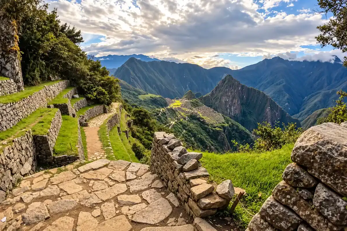
The Inca Trail starts at 2,700 m (8,858 ft) at KM 82, peaks at Dead Woman’s Pass, 4,215 m (13,828 ft), and ends at Machu Picchu, 2,430 m (7,972 ft). Over 43 km and four days you climb 2,150 m and descend 2,400 m, with almost all of the hard climbing packed into Day 2.
We guide the Classic Inca Trail from Cusco, and the numbers below are the same ones our guides use on the trail. You will find a quick reference table, our own elevation map and altitude profile, the gain and loss for every day, and a clear comparison with Cusco, Machu Picchu and the Salkantay Trek.
Inca Trail Elevation at a Glance
If you only need the key Inca Trail elevation figures for the Classic Inca Trail 4 Days, here they are. Every number refers to the standard route from KM 82 to the Machu Picchu citadel.
| Point | Elevation | Notes |
|---|---|---|
| Starting point (KM 82, Piscacucho) | 2,700 m / 8,858 ft | Permit checkpoint and bridge over the Urubamba River |
| Highest point (Warmiwañusca) | 4,215 m / 13,828 ft | Dead Woman’s Pass, reached on Day 2 |
| Highest campsite (Pacaymayo) | 3,600 m / 11,811 ft | Night 2 on the standard itinerary |
| Sun Gate (Inti Punku) | 2,720 m / 8,924 ft | First view of Machu Picchu on Day 4 |
| Lowest point (Machu Picchu) | 2,430 m / 7,972 ft | The citadel, end of the trail |
| Total distance | 43 km / 26.7 mi | Four days, three nights of camping |
| Total ascent | 2,150 m / 7,054 ft | More than half of it on Day 2 |
| Total descent | 2,400 m / 7,874 ft | Most of it on Day 3, on stone stairs |
The trail ends 270 m lower than it starts, yet you climb more than 2,000 m in between. That up and down profile, not the distance, is what makes the Inca Trail demanding.
How High Is the Inca Trail? Dead Woman’s Pass, the Highest Point
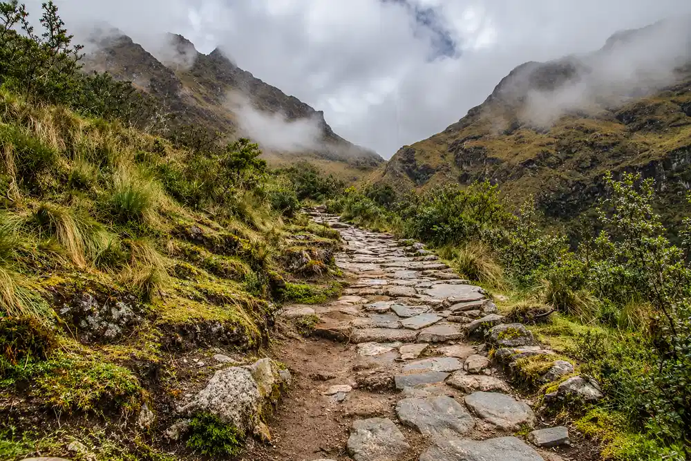
The highest point of the Inca Trail is Warmiwañusca, better known as Dead Woman’s Pass, at 4,215 m (13,828 ft). You cross it on the morning of Day 2, after a climb of 1,215 m from the Wayllabamba campsite that takes most hikers four to five hours.
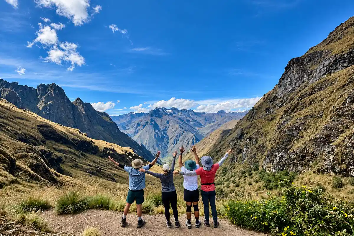
The name comes from Quechua: warmi means woman and wañusqa means dead. Seen from the valley below, the ridgeline looks like the silhouette of a woman lying on her back. It has nothing to do with an accident on the trail.
To picture the height, think of Colorado. Dead Woman’s Pass sits just 287 ft below the summit of Pikes Peak (4,302 m / 14,115 ft) and higher than Mount Hood in Oregon (3,429 m / 11,249 ft). You reach it on foot, on Inca stone steps, with no road anywhere near you.
The Three Passes of the Inca Trail
Dead Woman’s Pass is the highest, but it is not the only climb. The Classic route crosses three mountain passes, and the second and third come on Day 3.
| Pass | Elevation | Day |
|---|---|---|
| Warmiwañusca (Dead Woman’s Pass) | 4,215 m / 13,828 ft | Day 2 |
| Runkurakay Pass | 3,950 m / 12,959 ft | Day 3, morning |
| Phuyupatamarca | 3,680 m / 12,073 ft | Day 3, midday |
A common mix up: the round Runkurakay ruins sit below the pass, at 3,750 m. The pass itself is 200 m higher, so do not let a sign at the ruins convince you that the climb is over.
Inca Trail Elevation Map and Altitude Profile
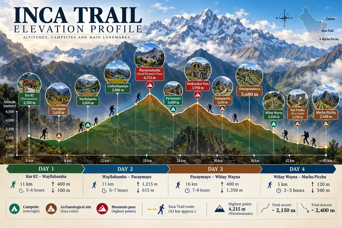
Our Inca Trail elevation profile shows every campsite, archaeological site and pass in the order you meet them, with the distance from KM 82. Use it to see where the climbs fall and how fast the trail drops after Phuyupatamarca.
| Place | Km from start | Elevation | Type |
|---|---|---|---|
| KM 82 (Piscacucho) | 0 | 2,700 m / 8,858 ft | Trailhead |
| Llactapata (Patallacta) | 6 | 2,650 m / 8,694 ft | Inca site |
| Wayllabamba | 11 | 3,000 m / 9,843 ft | Campsite, night 1 |
| Llulluchapampa | 15 | 3,800 m / 12,467 ft | Campsite and rest stop |
| Warmiwañusca | 18 | 4,215 m / 13,828 ft | Highest pass |
| Pacaymayo | 22 | 3,600 m / 11,811 ft | Campsite, night 2 |
| Runkurakay Pass | 25 | 3,950 m / 12,959 ft | Second pass |
| Sayacmarca | 29 | 3,650 m / 11,975 ft | Inca site |
| Phuyupatamarca | 35 | 3,680 m / 12,073 ft | Third pass and Inca site |
| Wiñay Wayna | 38 | 2,650 m / 8,694 ft | Campsite, night 3, and Inca site |
| Inti Punku (Sun Gate) | 42 | 2,720 m / 8,924 ft | First view of Machu Picchu |
| Machu Picchu | 43 | 2,430 m / 7,972 ft | End of the trail |
Swipe the table sideways to see more →
Read the profile as three blocks. The first 11 km are a gentle warm up along the Urubamba and Cusichaca valleys. The next 11 km are one long climb to the pass and a steep drop to Pacaymayo. The last 21 km roll over two smaller passes and then fall more than 1,000 m into the cloud forest.
Inca Trail Elevation Gain by Day
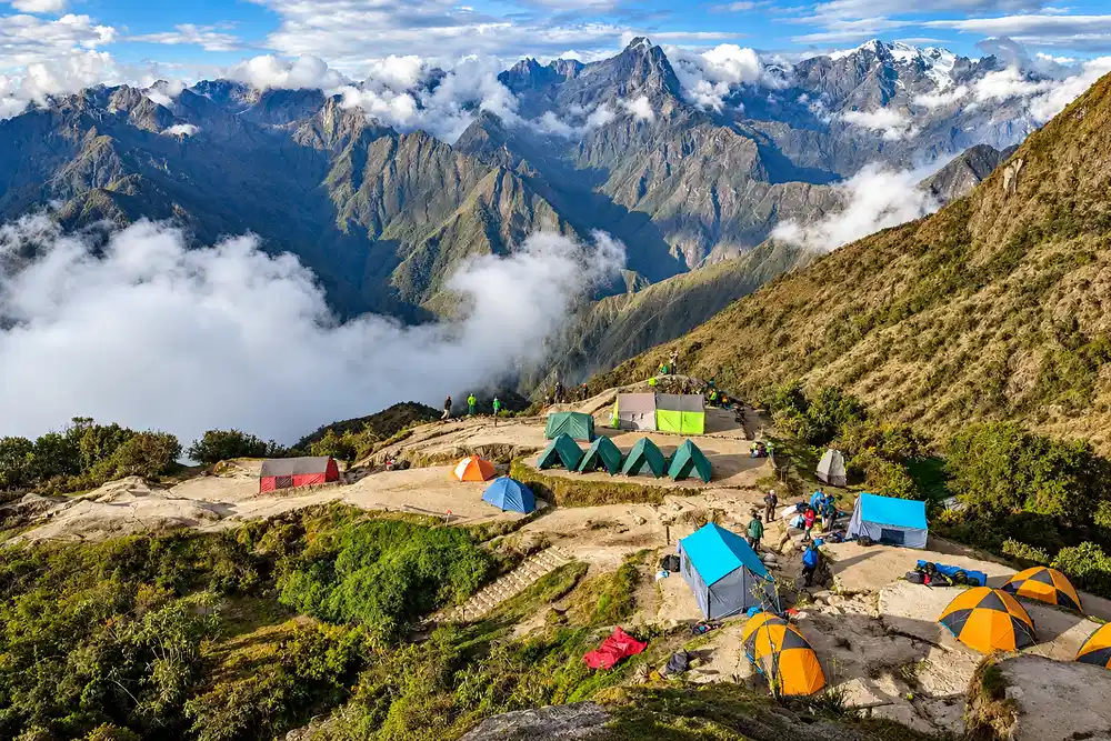
This is the Inca Trail elevation gain and loss, day by day, for the standard campsite combination: Wayllabamba, Pacaymayo and Wiñay Wayna. Hours are walking time at a steady pace, without long stops at the ruins.
| Day | Route | Distance | Hours | Gain | Loss |
|---|---|---|---|---|---|
| Day 1 | KM 82 to Wayllabamba | 11 km / 6.8 mi | 5 to 6 | 400 m | 100 m |
| Day 2 | Wayllabamba to Pacaymayo | 11 km / 6.8 mi | 6 to 7 | 1,215 m | 615 m |
| Day 3 | Pacaymayo to Wiñay Wayna | 16 km / 9.9 mi | 7 to 8 | 400 m | 1,350 m |
| Day 4 | Wiñay Wayna to Machu Picchu | 5 km / 3.1 mi | 2 to 3 | 120 m | 340 m |
| Total | KM 82 to Machu Picchu | 43 km / 26.7 mi | 20 to 24 | 2,150 m | 2,400 m |
Swipe the table sideways to see more →
Day 1: KM 82 to Wayllabamba (2,700 m to 3,000 m)
Day 1 is the easiest day of the trek. You cross the Urubamba at KM 82, walk past the terraces of Llactapata and follow the Cusichaca valley up to Wayllabamba. The net gain is only 300 m, so this is the day your body adjusts to carrying a pack at altitude.
Day 2: Wayllabamba to Pacaymayo (3,000 m to 4,215 m to 3,600 m)
Day 2 is the hardest day of the Inca Trail and the reason most people ask about elevation. You gain 1,215 m in 7 km, passing the cloud forest of Ayapata and the open grassland of Llulluchapampa, then reach Dead Woman’s Pass before lunch. After the pass, a steep staircase drops 615 m to the Pacaymayo campsite.
Our advice from the trail: walk slower than you think you need to on the way up, and save your knees on the way down. The descent to Pacaymayo is where most blisters and sore knees start, not the climb.
Day 3: Pacaymayo to Wiñay Wayna (3,600 m to 2,650 m)
Day 3 is the longest day, at 16 km, and many hikers find it the most beautiful. You climb 350 m to Runkurakay Pass in the first two hours, visit Sayacmarca and Phuyupatamarca, and then descend more than 1,000 m on Inca stairs to Wiñay Wayna. Trekking poles make a real difference here.
Day 4: Wiñay Wayna to Machu Picchu (2,650 m to 2,430 m)
Day 4 starts before dawn and is short: 5 km to the citadel. The trail stays almost flat until a final flight of very steep stone steps just below the Sun Gate at 2,720 m. From there you walk down 290 m to Machu Picchu with the citadel in full view.
How the Numbers Change With Other Campsites
Not every operator uses the same camps. On our Inca Trail 4 Days we camp at Ayapata (3,300 m) on night 1 and Chaquicocha (3,600 m) on night 2. Camping higher on Day 1 shortens the Day 2 climb to the pass to 915 m, and pushing on to Chaquicocha moves Runkurakay Pass to Day 2.
The result is a longer Day 2 with two passes, and a much more relaxed Day 3 with time to enjoy Phuyupatamarca and Wiñay Wayna. Total distance, total gain and the highest point stay exactly the same.
How Long Is the Inca Trail? Distance and Total Elevation Gain
The Classic Inca Trail is 43 km (26.7 miles) long and takes four days and three nights. Total walking time is 20 to 24 hours, spread over days of 2 to 8 hours each. Distance alone is moderate; the 2,150 m of climbing and 2,400 m of descent on stone steps is what makes it a real trek.
For comparison, the total ascent of the Inca Trail is more than five times the height of the Empire State Building. The difference is that you do it at altitude, over four days, with a porter team carrying the camp.
| Route | Distance | Days | Highest point |
|---|---|---|---|
| Classic Inca Trail | 43 km / 26.7 mi | 4 | 4,215 m / 13,828 ft |
| Short Inca Trail (KM 104) | 12 km / 7.5 mi | 2 (one day of hiking) | 2,720 m / 8,924 ft |
| Salkantay Trek | Longer route, no permit needed | 4 to 5 | 4,630 m / 15,190 ft |
Swipe the table sideways to see more →
The Inca Trail runs on a strict permit system: 500 permits per day for the Classic route, including guides and porters, and the trail closes every February for maintenance. Read our Inca Trail permit guide before you choose dates, and check the best time to hike the Inca Trail.
Short Inca Trail (2 Days, KM 104) Elevation
The Short Inca Trail starts at KM 104 (Chachabamba), at 2,150 m (7,054 ft), and climbs 570 m to the Sun Gate at 2,720 m. It joins the Classic route at Wiñay Wayna, so you finish on the same final stretch and enter Machu Picchu through Inti Punku.
Its highest point is 679 m lower than Cusco, which makes it the right choice for travelers worried about altitude or short on time. We cover the full route, the permits and the alternatives in our guide to the Machu Picchu two day hike, and you can book it as the Inca Trail 2 Days.
Inca Trail vs Salkantay, Cusco and Machu Picchu Elevation
Most travelers spend their first nights in Cusco or the Sacred Valley, so it helps to see the Inca Trail elevation next to the places you already know.
| Place | Elevation | Compared with Dead Woman’s Pass |
|---|---|---|
| Aguas Calientes | 2,040 m / 6,693 ft | 2,175 m lower |
| Machu Picchu citadel | 2,430 m / 7,972 ft | 1,785 m lower |
| Huayna Picchu | 2,693 m / 8,835 ft | 1,522 m lower |
| Ollantaytambo | 2,792 m / 9,160 ft | 1,423 m lower |
| Machu Picchu Mountain | 3,082 m / 10,112 ft | 1,133 m lower |
| Cusco | 3,399 m / 11,152 ft | 816 m lower |
| Warmiwañusca (Inca Trail) | 4,215 m / 13,828 ft | Highest point of the trail |
| Salkantay Pass | 4,630 m / 15,190 ft | 415 m higher |
| Rainbow Mountain | 5,036 m / 16,522 ft | 821 m higher |
Yes, Machu Picchu is lower than Cusco, by 969 m (3,180 ft). That surprises many visitors, and it is good news: the trek ends lower than where you acclimatized.
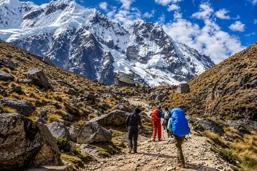
The Salkantay Trek goes much higher. Its pass is 415 m above Dead Woman’s Pass, and you sleep higher too. Our guide to the Salkantay Pass elevation has the full profile, and our Salkantay Trek vs Inca Trail comparison helps you choose between the two.
Altitude Sickness on the Inca Trail and How to Acclimatize
Here is the fact most guides leave out: the highest night on the standard Inca Trail is Pacaymayo, at 3,600 m, only 201 m above Cusco. If you are well acclimatized to Cusco, you spend just a few hours above that level, on the climb to Dead Woman’s Pass and the walk down from it.
That is why acclimatization before the trek matters more than anything you do on it. Flying straight from sea level to Cusco is the real risk: the CDC Yellow Book reports altitude illness rates close to 50% on this kind of rapid ascent, and a study of 991 travelers in Cusco found acute mountain sickness in 48.5% of them.
Plan at least two to three nights in the Sacred Valley or Cusco before KM 82. The Sacred Valley is lower than Cusco, which makes it the easiest place to start; our Sacred Valley altitude guide explains the best order for your first days. On the trail, walk at a steady pace, drink often and tell your guide about any headache, nausea or dizziness early.
Acetazolamide (Diamox) is the standard preventive medication, at 125 mg every 12 hours according to the Wilderness Medical Society 2024 guidelines. Speak to your doctor before your trip; this article does not replace medical advice. By regulation, every licensed Inca Trail operator must carry oxygen and a first aid kit, and our guides carry both on every departure.
Frequently Asked Questions
What is the elevation gain on the Inca Trail?
The total elevation gain on the Classic Inca Trail is 2,150 m (7,054 ft), with 2,400 m (7,874 ft) of descent. The biggest single climb is on Day 2: 1,215 m from Wayllabamba to Dead Woman’s Pass.
What is the highest elevation on the Inca Trail?
The highest elevation is Warmiwañusca, or Dead Woman’s Pass, at 4,215 m (13,828 ft). You cross it on Day 2 of the four day trek.
What elevation does the Inca Trail start at?
The Classic Inca Trail starts at KM 82 (Piscacucho), at 2,700 m (8,858 ft), reached by road from Cusco early in the morning. The Short Inca Trail starts lower, at KM 104, at 2,150 m (7,054 ft).
Which day of the Inca Trail is the hardest?
Day 2 is the hardest, with a 1,215 m climb to Dead Woman’s Pass followed by a steep 615 m descent. Day 3 is the longest, at 16 km, and is hardest on the knees.
Is Machu Picchu lower than Cusco?
Yes. Machu Picchu sits at 2,430 m (7,972 ft) and Cusco at 3,399 m (11,152 ft), so the citadel is 969 m lower. Most travelers feel the altitude far less at Machu Picchu than in Cusco.
Is the Inca Trail higher than the Salkantay Trek?
No. The Salkantay Pass reaches 4,630 m (15,190 ft), 415 m higher than Dead Woman’s Pass. The Salkantay Trek is the higher of the two routes; the Inca Trail has more stone steps and more Inca sites along the way.