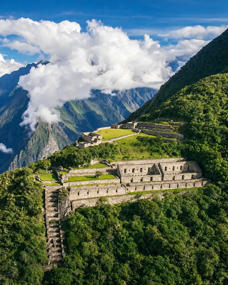

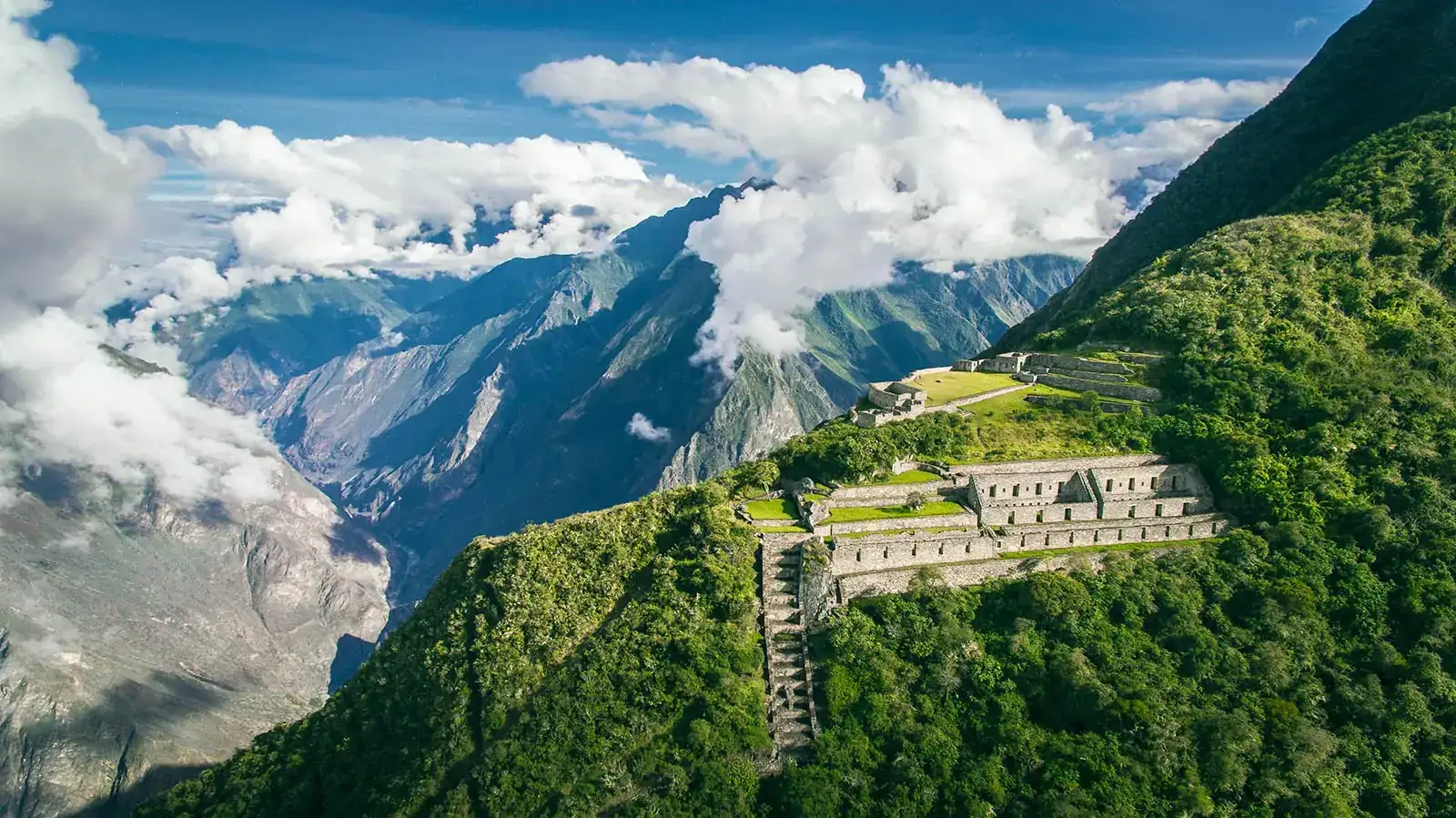
Choquequirao is an Inca city at about 3,050 m (10,007 ft) above the Apurímac canyon, in Peru’s Cusco region. You can only reach it on foot: the round trip from Capuliyoc takes four to five days.
In return, you share the ruins with around 25 visitors a day instead of the thousands who enter Machu Picchu. A cable car is planned, but as of October 2026 the contract has not even been awarded.
We are a local tour operator in Cusco and we take travelers to Choquequirao regularly. This guide gives you the facts for 2026: location, how to get there, the trek, entrance fee, best time to go and where the cable car project really stands.
What Is Choquequirao? Machu Picchu’s Sister City
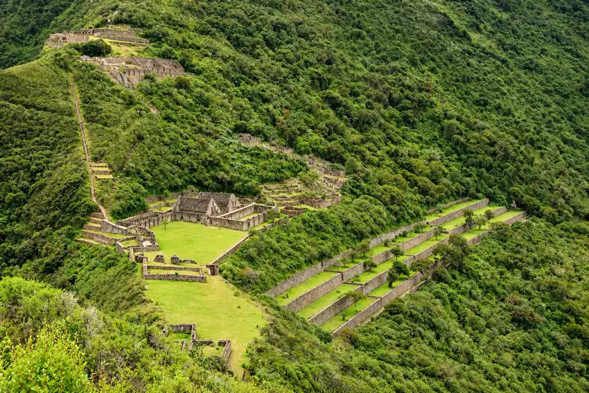
Choquequirao is an Inca site from the 15th and 16th centuries. The name comes from Quechua (chuqi k’iraw) and is usually translated as “cradle of gold”.
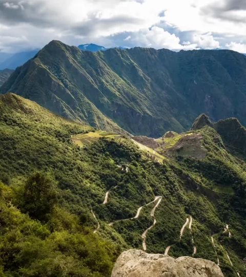
The complex sits on a ridge high above the Apurímac River. It includes plazas, temples, storehouses, water channels and very steep terraces spread over several hundred meters of elevation.
Who built Choquequirao?
Many sources credit the Inca rulers Pachacútec or Túpac Yupanqui. There is no solid academic proof of that. Peruvian archaeologists describe several building phases, and the main one may be older than Machu Picchu.
Choquequirao was probably a checkpoint on the way into Vilcabamba and a link between Cusco and the Amazon lowlands. It is tied to Manco Inca, who retreated to Vilcabamba after 1536.
The idea that it was “the last refuge of the Incas” is a popular reading, not an established fact.
Discovery and excavation
The site appears in writing as early as 1768. The Frenchman Eugène de Sartiges visited in 1834. Hiram Bingham arrived in 1909, two years before he reached Machu Picchu. He did not discover Choquequirao, but he made it known abroad.
Only part of the complex has been cleared. The usual estimate is 30 to 40 percent, although no official figure exists. The rest is still under cloud forest.
Why “sister of Machu Picchu”?
Both sites date from the same period, both sit on a ridge above a canyon, and both share the same layout of terraces, plazas and channels. In a straight line they are only about 50 km (30 miles) apart.
Choquequirao is not a UNESCO World Heritage Site in its own right. What has been listed since 2014 is the Vitkos–Choquequirao section of the Qhapaq Ñan, the Andean road system.
Where Is Choquequirao? Location and Altitude
The ruins are in the Cusco region, La Convención province, Santa Teresa district. The classic access, however, starts in the neighboring Apurímac region, at the village of Cachora and the Capuliyoc viewpoint.
The Apurímac River runs between them and marks the border between the two regions. That is why some sources say “Choquequirao, Cusco” and others “Choquequirao, Apurímac”. Both are partly right.
The city itself spreads between about 3,000 and 3,100 m (9,850 to 10,170 ft), with the main plaza near 3,050 m. From the river up to the ruins you gain roughly 1,500 m (4,900 ft).
| Point on the route | Altitude (approx.) | What you find there |
|---|---|---|
| Capuliyoc | 2,900 to 2,950 m (9,500 to 9,700 ft) | Viewpoint, checkpoint, start of the trail |
| Chiquiska | 1,900 to 1,950 m (6,200 to 6,400 ft) | Camp with simple meals |
| Playa Rosalina (Apurímac River) | about 1,500 m (4,900 ft) | Bridge, lowest and hottest point |
| Santa Rosa | 2,000 to 2,200 m (6,600 to 7,200 ft) | Camp on the opposite slope |
| Marampata | 2,850 to 2,900 m (9,350 to 9,500 ft) | Village with guesthouses and a view of the ruins |
| Choquequirao | 3,000 to 3,100 m (9,850 to 10,170 ft) | Archaeological park and campsite |
These altitudes come from GPS tracks and operator data. They vary by 50 to 150 m depending on the source, because the camps have never been officially surveyed.
What to See at Choquequirao: Llama Terraces, Main Plaza and Temples
Allow three to four hours for the core of the site. Add the llama terraces and it becomes almost a full day. According to Cusco’s culture authority, the park is open daily from 7 am to 4 pm.
Main plaza and upper sector
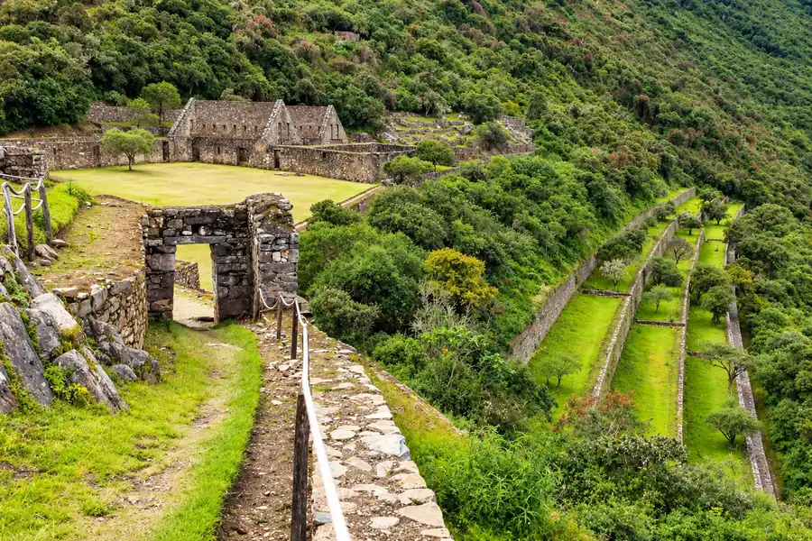
The main plaza (Haucaypata) is the heart of the city. Around it stand two-story buildings, long halls (kallankas) and water basins. Above it lie the upper sector (Hanan) and the storehouses, once fed by a channel from the mountain.
The Ushnu, the ceremonial platform
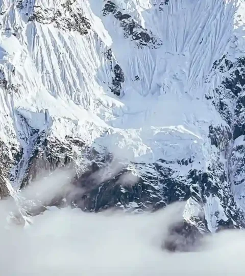
The Ushnu is a flattened hilltop at the end of the ridge. It gives you the best all-round view of the canyon, the ruins and the snow peaks of the Vilcabamba range. With some luck, condors glide over the valley.
The llama terraces
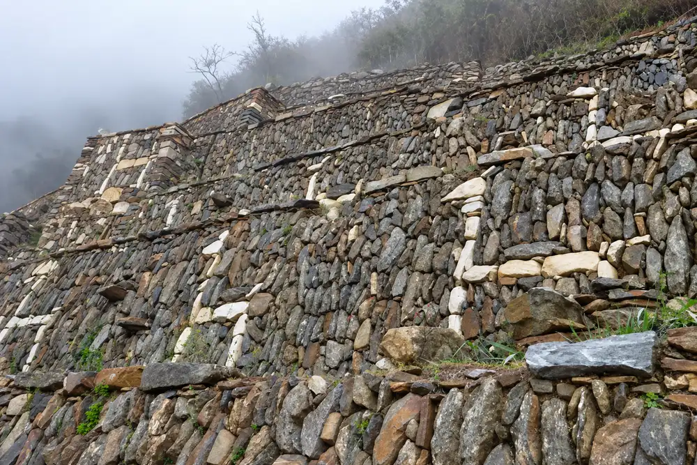
The most famous feature is on the west side, below the main plaza. Set into the terrace walls are around 23 to 24 llamas made of white quartzite, plus a few human and geometric figures.
They were found only in 2004 by Cusco archaeologist Zenobio Valencia. Every llama faces north, toward the sacred mountain Qoriwayrachina.
The way down follows steep Inca stairs, and you climb the same stairs back up. Plan on about two extra hours and save some energy for it.
The best light for photos
Mornings often bring mist on the mountain, and the afternoon is usually clearer. On our tour you arrive in the afternoon and go in again at sunrise, so you see the site in both moods.
How to Get to Choquequirao from Cusco
No road reaches the ruins. From Cusco you drive four to five hours to Capuliyoc and walk from there.
The route follows the paved Cusco–Abancay highway past Limatambo, Curahuasi and the Saywite stone. Shortly after, a side road turns off to Cachora. From Cachora a dirt track continues to Capuliyoc.
By public transport
- Take a bus toward Abancay from Cusco and get off after three to four hours at the turnoff called “Ramal de Cachora”.
- Shared taxis and private taxis run from there to Cachora and on to Capuliyoc. There are no fixed fares, so agree on the price before you leave.
- Travel by day. Mountain roads in this area are slow and winding, and night buses are best avoided.
Cachora or Capuliyoc?
Cachora is the village with lodging, shops and muleteers. Capuliyoc is the viewpoint where the track ends and the trail begins. Driving all the way to Capuliyoc saves you two to three hours of walking on the track.
Bring enough cash in Peruvian soles, ideally in small notes. There is no ATM anywhere on the route, so withdraw in Cusco before you set off.
The Choquequirao Trek: Route, Duration and Difficulty
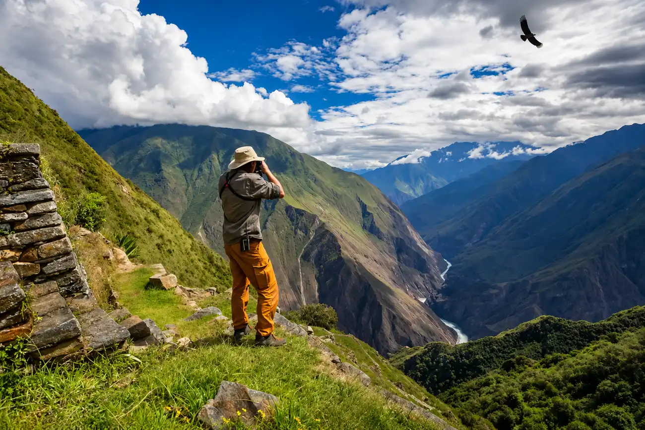
The Choquequirao trek covers 60 to 65 km (37 to 40 miles) round trip. You cross the Apurímac canyon twice, which adds up to roughly 3,000 to 3,500 m (9,800 to 11,500 ft) of climbing and the same amount of descent.
Altitude is not the hard part, since the highest point, about 3,100 m, is lower than Cusco. What wears you down are the long, steep descents and climbs and the heat at the bottom of the canyon.
The route in four days
| Day | Stage | Walking time (approx.) |
|---|---|---|
| 1 | Cusco, drive to Capuliyoc, descent via Chiquiska to the river, climb to Santa Rosa | 6 to 7 hours |
| 2 | Santa Rosa, climb to Marampata, on to Choquequirao in the afternoon | about 6 hours |
| 3 | Choquequirao at sunrise, descent to the river, climb to Chiquiska | 6 to 7 hours |
| 4 | Chiquiska, climb to Capuliyoc, stop at the Saywite stone, drive back to Cusco | about 4 hours |
This is also how our Choquequirao Trek 4 Days runs. That page has the detailed daily plan, what is included and the prices. If you want more time in the ruins, choose five days.
How hard is the trek, honestly?
It is demanding. It is regularly ranked among the toughest treks in Peru. You need no climbing skills, but you do need good fitness and knees that can take long descents.
To train, do mountain hikes with 1,000 m (3,300 ft) of ascent in a day. If you can do that two days in a row at home, you are ready. Trekking poles take real pressure off your knees on the way down.
For comparison, the Inca Trail and Salkantay cross passes of 4,200 to 4,600 m, where altitude is the challenge. Choquequirao stays lower but asks for more climbing per day. We compare the two classics in Salkantay Trek vs Inca Trail.
Heat and biting flies in the canyon
By the river it reaches 28°C (82°F) during the day, while nights in Marampata drop to about 8°C (46°F). Start each climb early, before the sun hits the slope.
The lower canyon has small biting flies. Long, light clothing and a strong insect repellent belong in every pack.
Choquequirao Without a Guide or With a Tour?
Both are possible. Choquequirao has no mandatory guide and no daily quota, unlike the Inca Trail. The path is easy to follow, and every camp lets you pitch a tent and buy a simple meal.
On your own
- Campsites in Chiquiska, Playa Rosalina, Santa Rosa and Marampata usually cost about $3 a night.
- Basic rooms in Marampata cost about $9 to $22.
- A mule with a muleteer costs about $23 to $26 a day. You also pay for the muleteer’s return trip.
- The park campsite has toilets and cold showers, but no food for sale.
These prices come from 2025 and 2026 trip reports and can change. In total, budget about $150 to $250 for four days without a mule.
With a guided tour
Four-day group tours cost about $330 to $690 in 2026, depending on the operator and group size. Private tours cost considerably more.
In exchange, mules carry the gear, a cook handles the meals and a licensed guide explains the site. There are no signs and no on-site guides, so without one much of it stays plain stonework.
Our honest take
Experienced hikers with their own tent, some Spanish and spare days do fine alone. We suggest a tour for everyone else: with 12 to 15 kg (26 to 33 lb) on your back, the climb out of the canyon is brutal for most people.
Choquequirao vs Machu Picchu, and the Trek That Links Them
You do not have to choose. Machu Picchu is for everyone, while Choquequirao is for hikers who want Inca ruins without the crowds.
| Feature | Choquequirao | Machu Picchu |
|---|---|---|
| Altitude | about 3,050 m (10,007 ft) | about 2,430 m (7,970 ft) |
| Visitors | about 8,000 to 9,000 a year | up to 5,600 a day (high season 2026) |
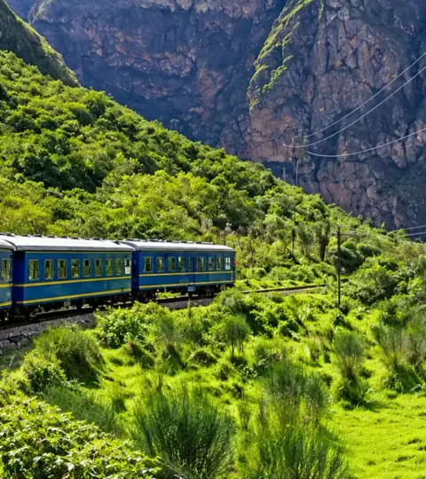
| Access | on foot only, two days in and two days out | train and bus, or the Inca Trail |
| Adult entrance fee | about $17 | from about $44 |
| Reservation | not needed | required, with date, route and time slot |
| Physical effort | very high | low |
| Cleared | an estimated 30 to 40 percent | almost entirely |
For how routes and prices work at Machu Picchu, see our guide to Machu Picchu tickets.
The long trek from Choquequirao to Machu Picchu
To link both on foot, you continue from Choquequirao through Maizal and Yanama to Santa Teresa and Aguas Calientes. It takes seven to nine days and crosses passes of about 4,600 m (15,100 ft).
At more than 100 km, it is one of the hardest routes in southern Peru and suits only experienced, well-acclimatized hikers. Every other way in is covered in What Path Leads to the Citadel of Machu Picchu?
Choquequirao Cable Car: Where It Stands in October 2026
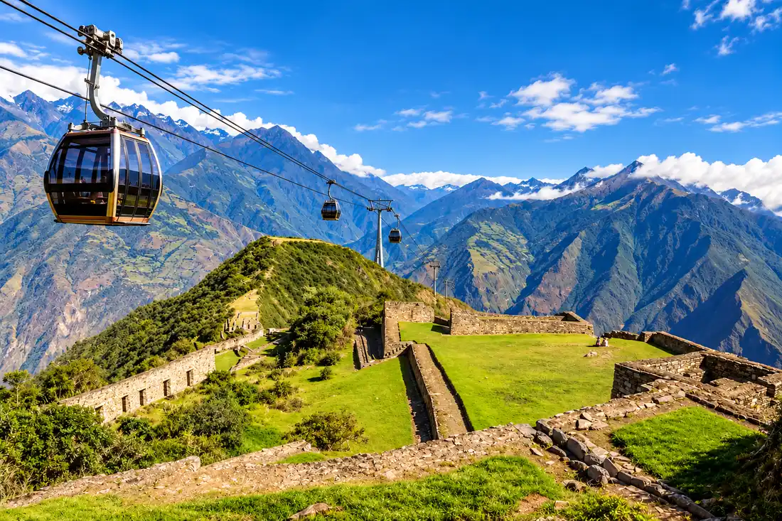
There is no cable car to Choquequirao, and none is being built yet. In October 2026 the project is still in the bidding stage. Some travel sites still claim it is “under construction” or already running. Neither is true.
What is planned
- Cost: about $261 million, as a public-private partnership.
- In charge: the tourism ministry MINCETUR and the state investment agency ProInversión.
- South line (Apurímac): a 4.2 km cable car from Kiuñalla, near Huanipaca, straight to Choquequirao.
- North line (Cusco): two sections from San Juan via Maizal to Choquequirao, 6.4 km in total.
- Ride time: about 20 minutes instead of two days on foot.
When the cable car will open
The award has been postponed several times since 2024. Most recently, ProInversión named October to November 2026 as the target, with construction starting in 2027.
The contract allows five years for design and construction. Even with no further delay, the cable car will not run before 2030. After that, authorities expect up to one million visitors a year instead of 8,000.
For you this means that in 2026, 2027 and very likely the years after, Choquequirao remains a hiking-only destination. If you want to see it almost empty, you still have time, but do not wait a decade.
Best Time to Visit Choquequirao and Weather
The best time is the dry season from May to October. The most pleasant months are May and June, when the canyon is still green, along with September and early October.
July and August are the driest, but they also bring the most hikers and the strongest midday heat by the river.
Warning: rainy season closures
From December to March it rains hard, the trail turns slippery and landslides are a risk. In 2026 the culture authority closed all access routes from February 1. The Capuliyoc route officially reopened only on April 15, 2026.
In 2025 the park was also closed for weeks from March because of rockfall. So do not plan Choquequirao for February or March, even though no closure has been announced for 2027 yet.
For a month by month picture of the region, see our Inca Trail weather guide.
Entrance Fee, Costs and Where to Sleep
The entrance fee is about $17 for adults, the same for Peruvians and foreigners. That is the rate in the current fee schedule of Peru’s Ministry of Culture.
| Category | Entrance fee |
|---|---|
| Adults | about $17 |
| Students with ID | about $9 |
| Children and teens aged 3 to 17 | about $7 |
| Age 60 and over | 50 percent discount |
| Children under 3 | free |
You pay in cash, in soles, at the checkpoint on the route, and you must show your passport. No advance booking is needed. Much higher prices quoted online are not official.
Where you sleep
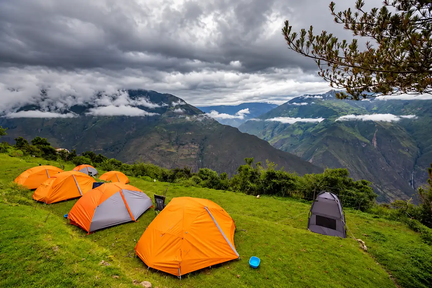
There are no hotels on the route. You sleep in a tent or in simple family guesthouses, mainly in Marampata. On a tour, the tent, sleeping mat and all meals are included.
Inside the park you may camp only at the official campsite. Drones need a permit from the culture authority, and you carry all your trash back out.
Is Choquequirao Worth It? Our Verdict
Choquequirao is worth it if you enjoy long, hard days on the trail and want a large Inca city almost to yourself. It does not replace Machu Picchu. It is the other side of the same story.
If you would like to do it with a guide, a cook and mules, see our Choquequirao Trek 4 Days or everything we offer on the Choquequirao Trek page. For more routes, read our overview of trekking tours in Peru.
Choquequirao FAQs
Can you visit Choquequirao without hiking?
No. There is no road, no train and no cable car. The only way in is on foot through the Apurímac canyon, at least two days in and two days out. A riding mule can make part of the route easier.
How many days do you need for Choquequirao?
Four days is the minimum and works well for fit hikers. Five days gives you a full day in the ruins and shorter stages.
Is altitude sickness a risk at Choquequirao?
Hardly. The highest point is about 3,100 m (10,170 ft), lower than Cusco at 3,400 m (11,150 ft). Still, spend two to three days in Cusco first so your body adjusts.
Is Choquequirao open in February?
Do not count on it. In 2026 the park was closed from February 1 to mid-April, and in 2025 from March. The safe season starts in May.
Is the Choquequirao trek suitable for children?
There is no official minimum age. Because of the elevation gain and the heat, we recommend the trek only for sporty teenagers from about 14.
Do I need to book Choquequirao in advance?
No. There is no daily quota and you pay in cash at the checkpoint. On a guided tour the entrance fee is normally included.
How do you pronounce Choquequirao?
Say “cho-keh-kee-RAU”, with the stress on the last syllable. Locals often shorten it to “Choque”.
Is there drinking water and phone signal on the trail?
Every camp has water, but you should filter or boil it. Bottled water is sold at a high price. There is almost no phone signal in the canyon.