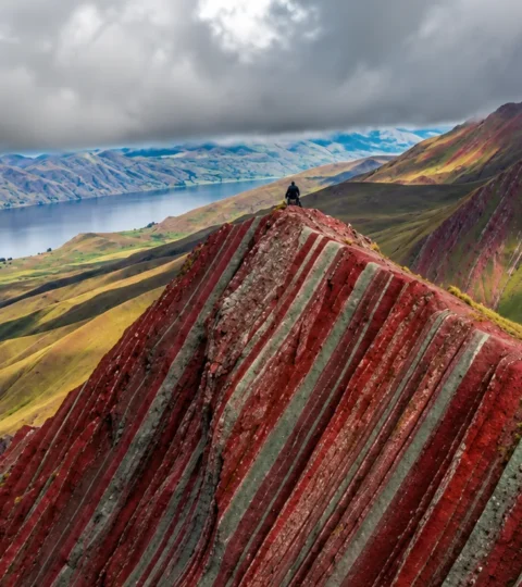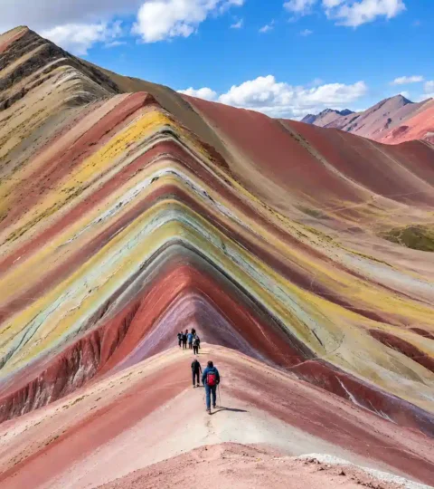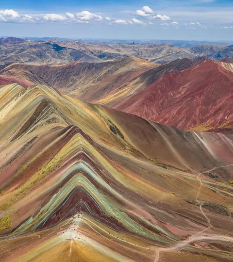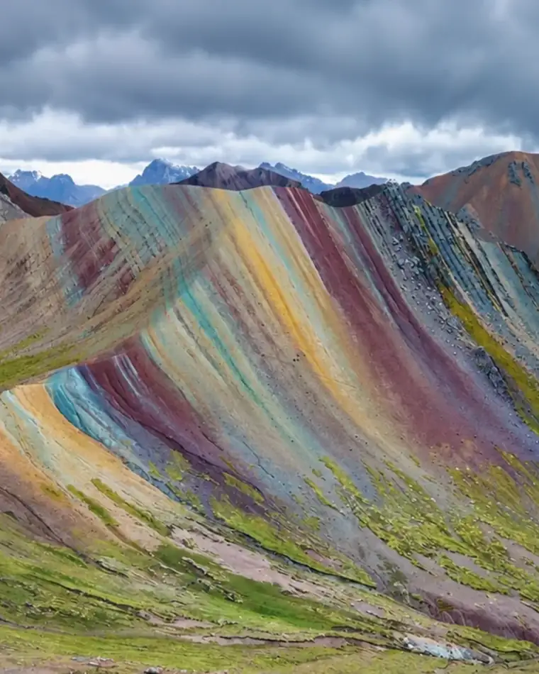

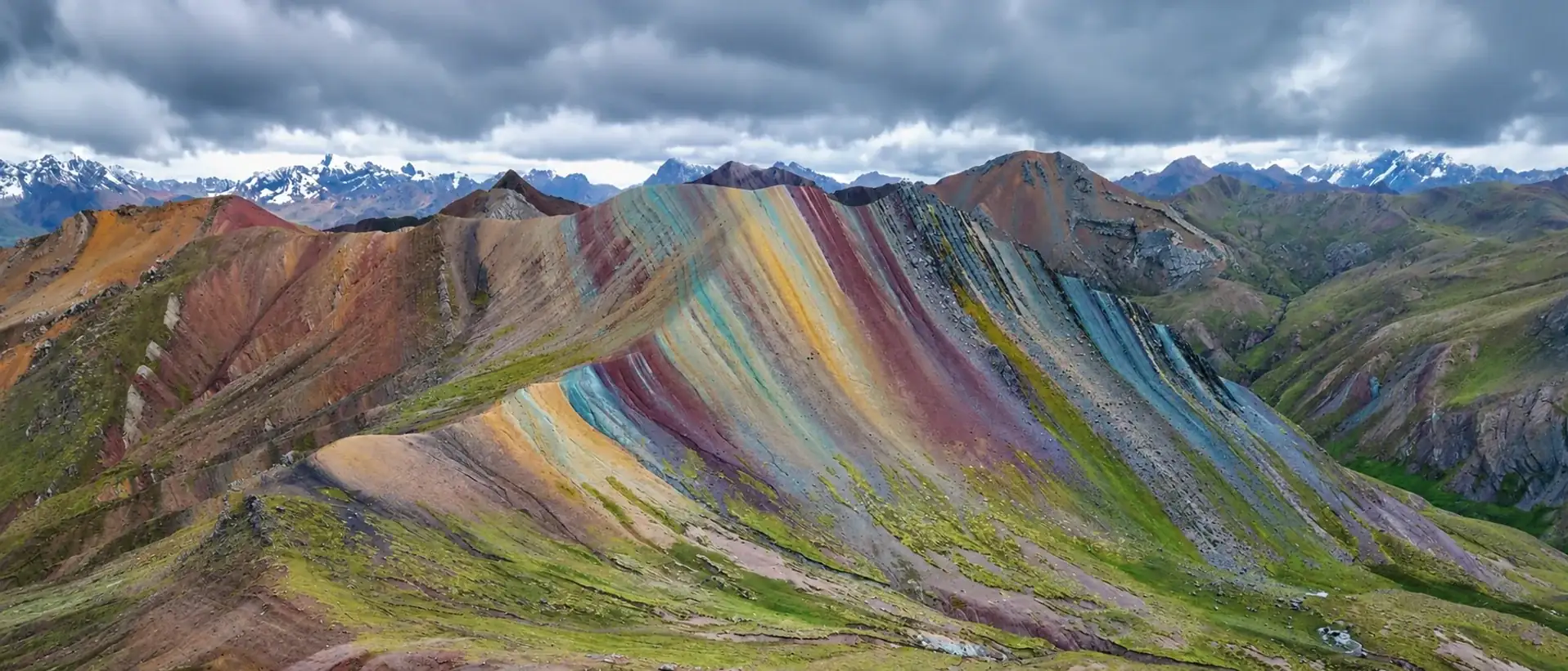
Palcoyo Mountain, officially spelled Palccoyo, is a group of rainbow colored ridges in the district of Checacupe, province of Canchis, about 140 km southeast of Cusco. The walk is short and gentle: a loop of about 4 km with only some 170 m of climbing.
It is the easier alternative to Rainbow Mountain (Vinicunca). The van drives almost to the viewpoints, the highest point stays below 5,000 m and you share the trail with far fewer people. The reward: striped hills, a stone forest and Ausangate on the horizon.
We are a local tour operator in Cusco and we run this trip every week. This guide combines our field notes with official sources: the national inventory of tourist resources, PromPerú, the regional tourism office and SENAMHI weather records. The altitudes come from our own satellite elevation measurements.
What Is Palcoyo Mountain?
Palcoyo is not a single peak. It is a small range of colored hills, and three of its ridges show the full rainbow stripes. A loop trail links several viewpoints, so you see the mountains from different angles instead of from one crowded summit.
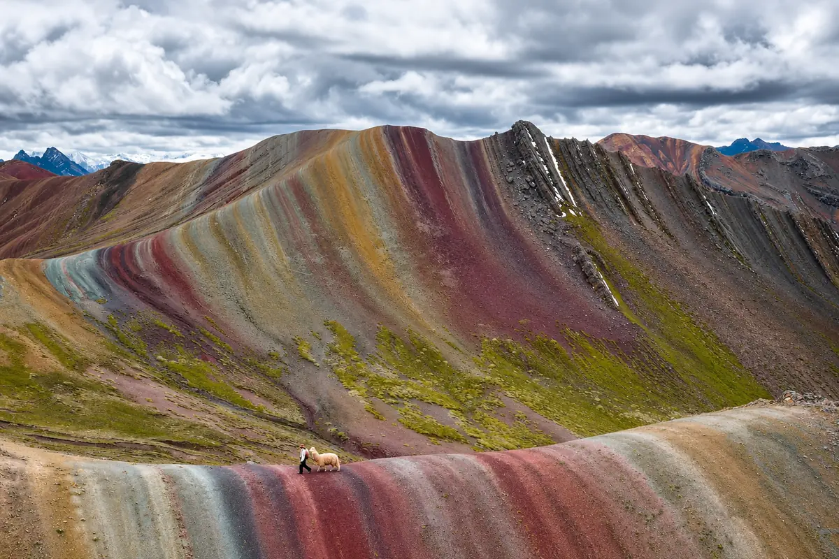
The site belongs to the peasant community of Palccoyo, which runs it together with the municipality of Checacupe. It opened to visitors in December 2016, and Peru’s tourism ministry lists it as “Cordillera Arco Iris, Palccoyo”.
Palcoyo or Palccoyo: Which Spelling Is Right?
Both names refer to the same place. Palccoyo, with a double c, is the official spelling used by the community, the tourism ministry and PromPerú. Most travel sites write Palcoyo, and you will also see Palcoyo Rainbow Mountain.
Some websites explain the name with a Quechua meaning. We found no reliable source for it, so we prefer not to repeat one.
Why Palcoyo Has Colors
The stripes are layers of sedimentary rock, laid down at different times and later folded and tilted when the Andes rose. Each layer holds different minerals, and erosion exposes them side by side.
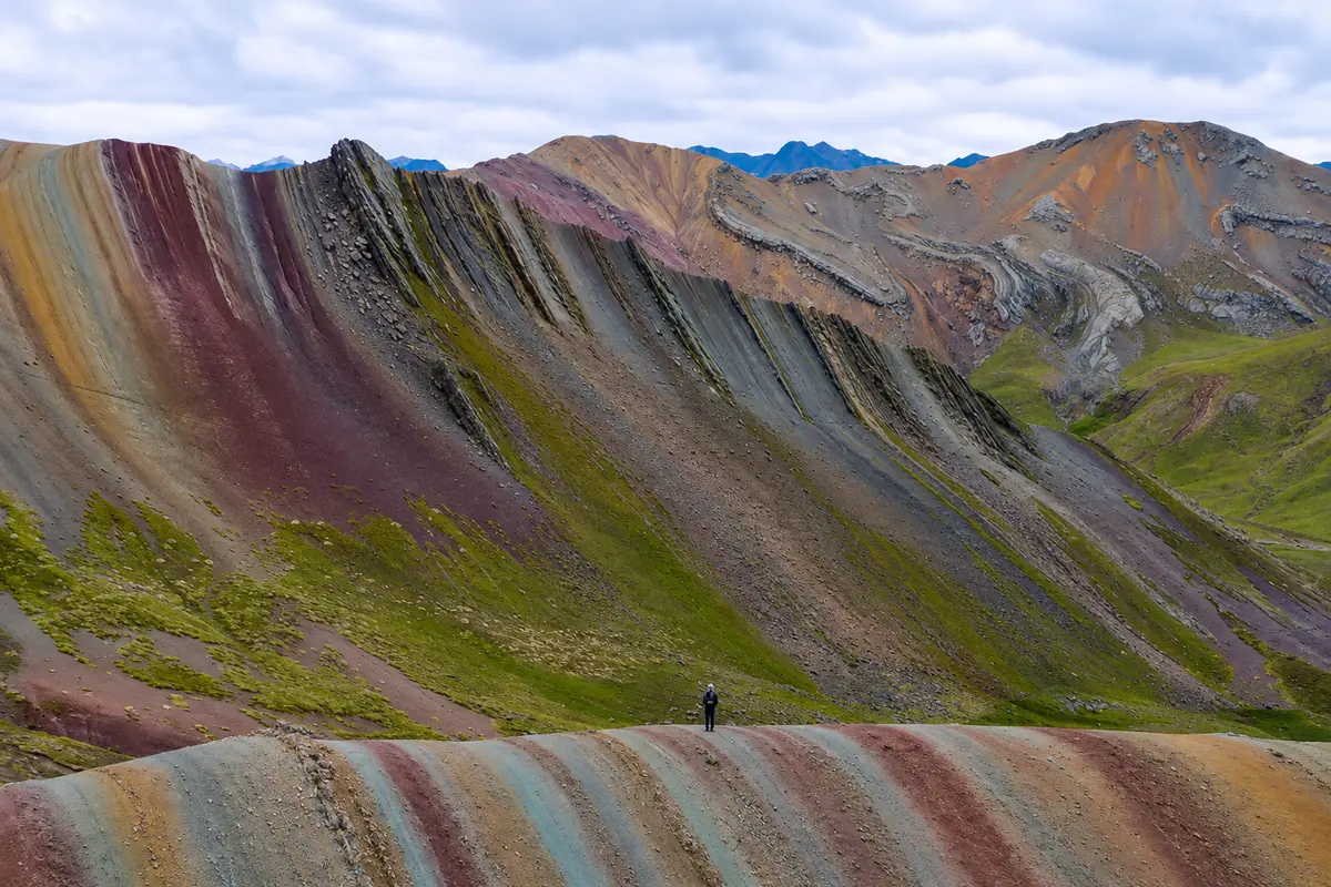
- Red and maroon: iron oxides and clays.
- Green and turquoise: minerals rich in iron and magnesium, such as chlorite.
- White and cream: quartz sandstones.
- Yellow and ochre: limonite and limy sandstone.
No geological study of Palcoyo itself has been published, so be careful with exact ages you may read online. The same process is explained in our article on why Rainbow Mountain in Peru is colorful.
Where Is Palcoyo? Distance and Route from Cusco
Palcoyo lies above the Salcca valley, east of the main highway between Cusco and Puno. The road heads south on the paved PE-3S through Urcos and Cusipata, turns off at Combapata and climbs the valley on a dirt road to the community parking area.
| Stretch | Road | Distance | Time by car |
|---|---|---|---|
| Cusco to Cusipata | Paved highway PE-3S | 83 km | About 1 hr 45 min to 2 hrs |
| Cusipata to Combapata | Paved highway PE-3S | 27 km | About 30 min |
| Combapata to the parking | Dirt road up the Salcca valley | 29 km | About 1 hr |
| Total, Cusco to Palcoyo | About 140 km | 3 to 3 hrs 30 min each way |
Swipe the table sideways to see more →
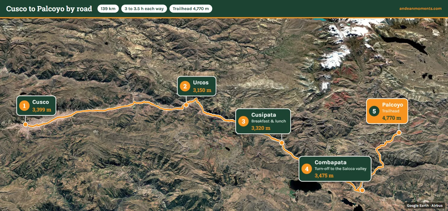
Many websites say 100 or 125 km. Our route measurement from the main square of Cusco gives 139 km, and the last 29 km are unpaved.
That explains the pickup between 4:30 and 5:00 a.m. on every tour: you reach the trail around 9:30 a.m., before the clouds build up over the ridges.
Palcoyo Altitude and Hike Difficulty
The trail starts at the parking area at about 4,770 m (15,650 ft). The viewpoints sit between 4,790 and 4,900 m, and the highest point of the loop is the stone forest, at about 4,940 m (16,207 ft). On foot you climb only about 170 m.
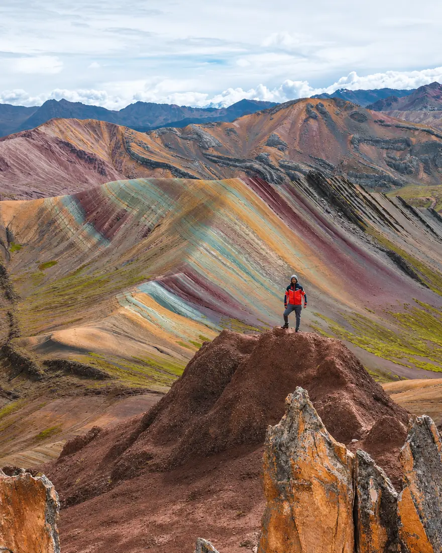
You will find different figures online. Tours and PromPerú round it to 4,900 m, the national inventory gives 4,787 to 4,850 m for the colored ridges, and some sites claim more than 5,000 m.
Our satellite elevation data matches the range above. The claims of more than 5,000 m are wrong for the trail; only the surrounding peaks, which nobody climbs on this trip, reach that height.
The Trail, Point by Point
The loop links six points. This is the order most groups follow:
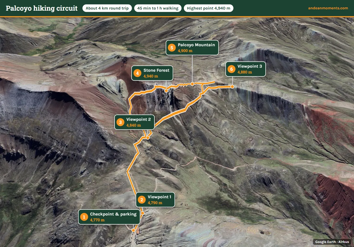
- Checkpoint and parking, 4,770 m: entrance booth, toilets and stalls with water and snacks.
- Viewpoint 1, 4,790 m: a few minutes up a stone path, your first view of the colored ridges.
- Viewpoint 2, 4,840 m: a gentle climb along the slope, with the rainbow hills on your right.
- Stone Forest, 4,940 m: the highest point, with rock pillars and the rainbow hills behind them.
- Palcoyo Mountain viewpoint, 4,900 m: the classic photo of the striped ridges.
- Viewpoint 3, 4,880 m: the last panorama before the trail drops back to the parking.
| Data | Palcoyo loop |
|---|---|
| Distance | About 4 km round trip |
| Climb | About 170 m (560 ft) |
| Walking time | 45 min to 1 hr |
| Time at the site | About 2 hrs, with viewpoints and photos |
| Difficulty | Easy terrain, high altitude |
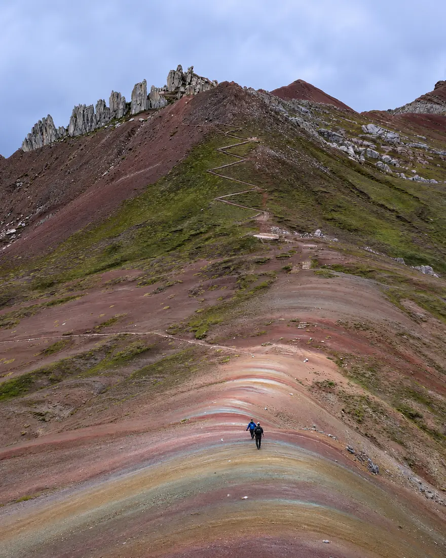
The first section is a wide stone path and the rest is a clear dirt trail. There are no horses for rent at Palcoyo, so you walk the whole loop yourself; at a slow pace, almost everyone can.
How to Avoid Altitude Sickness
Spend at least 2 nights in Cusco or the Sacred Valley before the trip. Drink plenty of water, skip alcohol the night before and walk slowly from the first step. Our guides carry oxygen and a first aid kit.
The same advice applies to all of Cusco’s colored mountains, and we explain it in detail in our Rainbow Mountain altitude guide.
How to Get to Palcoyo from Cusco
There are two ways: a day tour, which drives you to the parking area and back, or a bus plus a hired taxi, which works but takes more planning.
On a Tour
This is the simplest option and the one most visitors choose. Transport, guide, breakfast and lunch are solved, and you are back in Cusco around 4:30 p.m. Shared tours run daily; a private tour lets you set your own pace.
On Your Own, Step by Step
- Cusco to Combapata: take a bus or shared van toward Sicuani from the terminal on Av. Huayruropata and ask to get off in Combapata. The ride takes about 2 hrs 30 min and costs about S/10.
- Combapata to Palcoyo: no public transport goes up the Salcca valley. Hire a taxi in Combapata for the 29 km of dirt road, about 1 hr each way, and agree on the price and waiting time before you leave.
- Return: the same taxi brings you back to Combapata, where buses to Cusco pass often during the day.
Leave Cusco before 6:00 a.m. to reach the trail in the morning. Carry cash in small bills, and keep in mind that there is no phone signal at Palcoyo, so you cannot call a taxi from the parking area.
The Palcoyo Tour: What the Day Looks Like
A full day tour lasts about 12 hours, with two meals in Cusipata. This is the schedule of our Palcoyo Rainbow Mountain tour:
| Time | What happens |
|---|---|
| 4:30 to 5:00 a.m. | Hotel pickup in Cusco |
| 7:00 to 8:00 a.m. | Breakfast in Cusipata |
| 8:00 to 9:30 a.m. | Drive up the Salcca valley to Palcoyo |
| 9:30 to 11:30 a.m. | Guided hike, viewpoints and the stone forest |
| 11:30 a.m. to 12:00 p.m. | Free time for photos |
| 12:00 to 1:30 p.m. | Drive back to Cusipata |
| 1:30 to 2:15 p.m. | Buffet lunch in Cusipata |
| 2:15 to 5:00 p.m. | Return to Cusco, arriving around 4:30 to 5:00 p.m. |
The Stone Forest
The stone forest (bosque de piedras) is what makes Palcoyo different from the other colored mountains. Tall pillars of pale rock, shaped by wind and frost, line the highest part of the loop, with the rainbow ridges behind them.
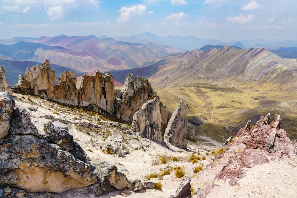
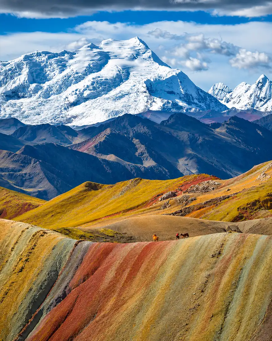
On a clear morning it is also the best spot to see Ausangate, the 6,384 m snow peak that rules the Vilcanota range. Watch your step between the rocks, because the ground is loose in places.
Palcoyo Entrance Fee and Prices in 2026
| Item | Price | Notes |
|---|---|---|
| Entrance fee, foreigners | S/20 (about US$6) | Cash, paid at the checkpoint |
| Entrance fee, Peruvians | S/15 | Cash |
| Toilets | S/2 | Only at the parking area |
| Water and snacks | A few soles | Sold at stalls near the parking |
| Group tour from Cusco | US$35 to 80 per person | Usual market range in 2026 |
| Our group tour | US$35 (US$30 promo) | Transport, guide, breakfast and lunch |
| Our private tour | US$255 for 1 person, US$275 for 2 | Your own van, guide and schedule |
The community sets the fee and collects it in cash. The last official figure, published in 2019, was S/10. Agencies report the current S/20 for foreigners and S/15 for Peruvians, in force since June 2026.
The entrance is not included in most tour prices, ours included. Bring small bills in soles: there are no card machines at the checkpoint and change is often short.
Best Time to Visit Palcoyo and the Weather
The best months are May to October, the dry season: clear skies, little rain and the dirt road in good shape. April and November are good transition months. From December to March it rains often, with storms, hail and some snow on the ridges.
The closest official weather station is Sicuani, at 3,534 m, in the same province. These are its SENAMHI averages for 1991 to 2020:
| Month | Average high | Average low | Rain |
|---|---|---|---|
| January | 18.8°C (66°F) | 6.2°C (43°F) | 136 mm |
| February | 18.7°C (66°F) | 6.2°C (43°F) | 140 mm |
| March | 19.1°C (66°F) | 5.7°C (42°F) | 110 mm |
| April | 19.5°C (67°F) | 3.5°C (38°F) | 51 mm |
| May | 19.5°C (67°F) | 0.6°C below zero (31°F) | 11 mm |
| June | 19.1°C (66°F) | 3.2°C below zero (26°F) | 2 mm |
| July | 18.9°C (66°F) | 3.5°C below zero (26°F) | 4 mm |
| August | 20.0°C (68°F) | 1.6°C below zero (29°F) | 6 mm |
| September | 20.8°C (69°F) | 1.7°C (35°F) | 18 mm |
| October | 20.8°C (69°F) | 3.9°C (39°F) | 53 mm |
| November | 21.0°C (70°F) | 4.6°C (40°F) | 75 mm |
| December | 19.7°C (67°F) | 5.5°C (42°F) | 106 mm |
Swipe the table sideways to see more →
The viewpoints are about 1,300 m higher than Sicuani, so expect it to be roughly 8°C (14°F) colder than the table shows: around 12°C at midday in the sun and below zero at dawn, with a cold wind on the ridges.
On a dry season morning the sky turns deep blue, the stripes look sharp and the community’s alpacas graze right next to the trail.
Storms and Lightning in the Rainy Season
Afternoon thunderstorms are common from December to March, and Palcoyo’s ridges are exposed. In December 2018 two visitors were struck by lightning at the site. Go in the morning, and walk down at once if you hear thunder.
Palcoyo vs Rainbow Mountain (Vinicunca) vs Pallay Punchu
Cusco has three colored mountains you can visit in one day. The right choice depends on what matters most to you: the famous view, an easy walk or a quiet place.
| Palcoyo | Rainbow Mountain (Vinicunca) | Pallay Punchu | |
|---|---|---|---|
| Highest point | About 4,940 m (16,207 ft) | 5,036 m (16,522 ft) | About 4,790 m (15,715 ft) |
| Distance from Cusco | About 140 km | About 100 to 120 km | About 190 km |
| Drive, each way | 3 to 3 hrs 30 min | About 3 hrs | About 4 hrs |
| Walk | About 4 km, 45 min to 1 hr | About 4 to 7 km, 3 to 4 hrs | 2.5 to 3 km, 1 hr 30 min to 2 hrs 30 min |
| Entrance 2026 | S/20 foreigners, S/15 Peruvians | S/30 foreigners, S/20 Peruvians | About S/10 |
| Visitors | Few | Up to about 1,500 a day in high season | Few |
| Landscape | Rainbow ridges, a stone forest and Ausangate | The classic rainbow slope, Red Valley and Ausangate | Sharp vertical ridges and a large lake |
Swipe the table sideways to see more →
Choose Palcoyo for the easiest walk and the shortest day, or if you arrived in Cusco only a few days ago. Choose Rainbow Mountain for the iconic view; our Rainbow Mountain and Red Valley tour adds the valley most visitors miss.
Choose Pallay Punchu for the most dramatic ridges and the fewest people, if a long drive does not bother you. Read our Pallay Punchu guide or see the Pallay Punchu tour.
What to Bring to Palcoyo
- Warm layers: a thermal base, a fleece and a light down jacket.
- A windbreaker or rain jacket, gloves and a warm hat.
- Hiking shoes with good grip for the loose ground around the stone forest.
- Sun protection: high SPF sunscreen, lip balm, sunglasses and a cap.
- Cash in soles, in small bills, for the entrance, toilets and snacks.
- A water bottle and a snack, although both are also sold at the parking area.
Two practical notes from our guides. Toilets cost S/2 and are only at the parking area, so use them before you start walking. And there is no phone signal at Palcoyo: download offline maps and send your messages before you leave Cusipata.
Is Palcoyo Worth It?
Yes, especially if Vinicunca feels like too much. Palcoyo gives you rainbow stripes, a stone forest and snow peaks with a fraction of the effort, and without the queue for the summit photo.
It suits travelers who arrived in Cusco recently, families, older travelers and anyone who prefers a gentle walk at high altitude to a steep climb. In 2026 the regional tourism office began promoting it, together with Pallay Punchu, as a quieter alternative to Vinicunca.
Two honest notes. The colors are softer than in edited photos and look best in the morning sun. And Palcoyo has no single famous slope like Vinicunca; its beauty is the wide landscape of several striped hills.
Frequently Asked Questions About Palcoyo
How high is Palcoyo Mountain?
The viewpoints are between about 4,790 and 4,900 m, and the stone forest, the highest point of the loop, reaches about 4,940 m (16,207 ft). The parking area sits at about 4,770 m.
How far is Palcoyo from Cusco?
About 140 km, or 3 to 3.5 hours by road each way. The last 29 km, up the Salcca valley from Combapata, are a dirt road.
How long is the Palcoyo hike?
The loop is about 4 km. Walking takes 45 minutes to 1 hour, and most groups spend about 2 hours at the site with the viewpoints and photos.
Is Palcoyo harder than Rainbow Mountain?
No. The walk is much shorter, you climb only about 170 m on foot and the highest point is about 100 m lower than the summit of Vinicunca. The altitude still makes you breathe hard, so walk slowly.
Is Palcoyo the same as Rainbow Mountain?
No. Rainbow Mountain, or Vinicunca, is a different mountain about 20 km to the north in a straight line, reached by another road. Palcoyo is a separate range of colored hills with its own trail and entrance.
Are there horses at Palcoyo?
Not for visitors. Unlike Vinicunca, there are no horses for rent, although you may see local families riding along the ridges. The walk is short and gentle enough that you will not need one.
Is there phone signal at Palcoyo?
No. There is no mobile signal at the site, so send your messages and download offline maps before you leave Cusipata.
Are there toilets at Palcoyo?
Yes, at the parking area, for S/2. There are no toilets along the trail.
Can children and older travelers visit Palcoyo?
Yes, if they are healthy and have spent a few days in Cusco: it is the gentlest of Cusco’s colored mountains. Anyone with heart or breathing problems should ask their doctor before going above 4,500 m.
Does it snow at Palcoyo?
Snow and hail can fall from December to March, and a light layer of snow on the ridges is not rare. In the dry season you will find frost at dawn, but rarely snow on the trail.
Sources: MINCETUR national inventory of tourist resources, PromPerú (peru.travel), Andina news agency, El Sol del Cusco and SENAMHI climate normals for Sicuani, 1991 to 2020. Altitudes measured with SRTM satellite elevation data. More day trips are on our day tours from Cusco page.