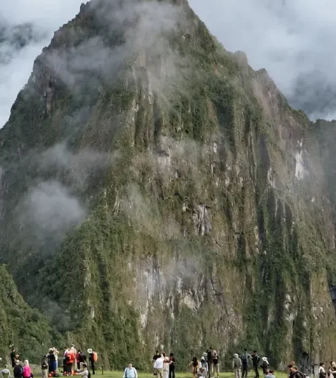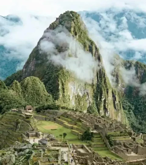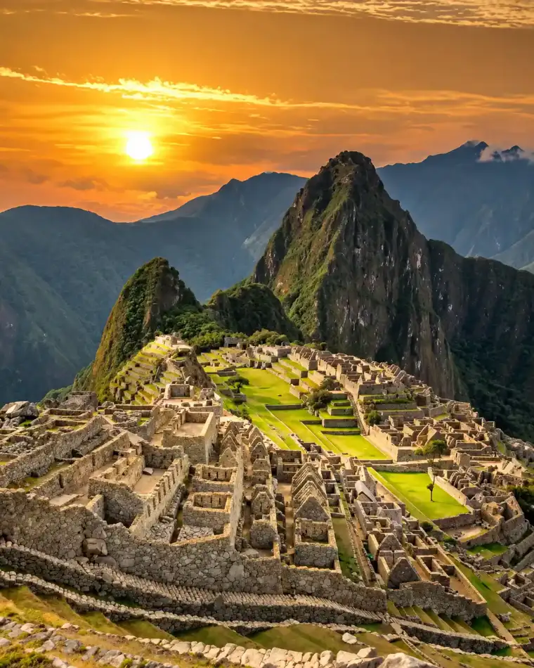

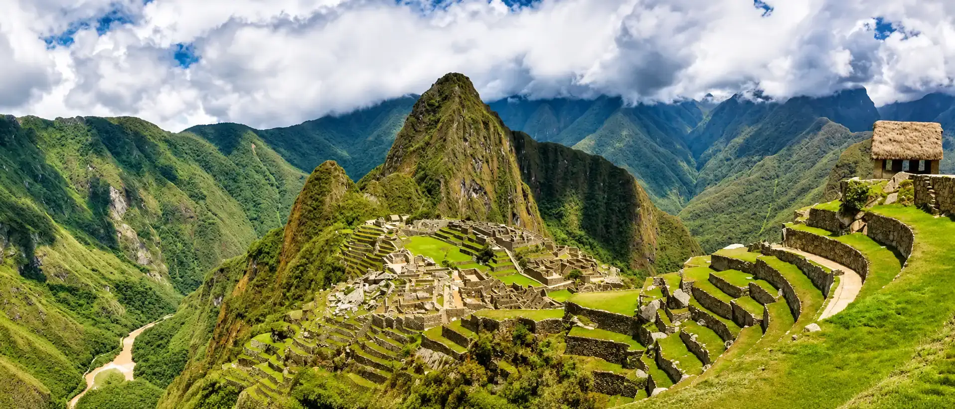
Huayna Picchu is the steep, exposed peak right behind the Inca city. Machu Picchu Mountain is higher and longer, but wider and with the broadest panorama. Huchuy Picchu is the short climb for travelers with little time or little head for heights.
All three are separate ticket routes with fixed entry times, and each ticket covers only one mountain.
We are a local tour operator in Cusco and we book these routes for our travelers all year. This guide compares the three hikes with the official 2026 numbers and tells you honestly who each one is for.
Huayna Picchu, Machu Picchu Mountain and Huchuy Picchu compared
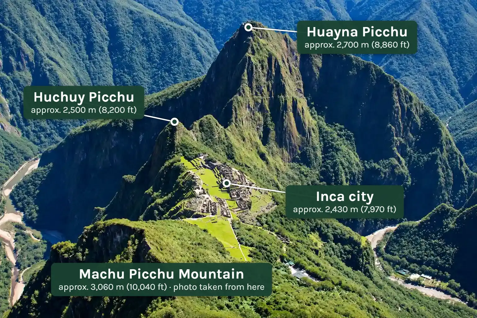
The citadel sits at about 2,430 m (7,970 ft). From there, three trails climb three very different summits. This table shows how they differ.
| Feature | Huayna Picchu | Machu Picchu Mountain | Huchuy Picchu |
|---|---|---|---|
| Official route | 3-A (Circuit 3) | 1-A (Circuit 1) | 3-D (Circuit 3) |
| Summit height | about 2,700 m (8,860 ft) | about 3,060 m (10,040 ft) | about 2,500 m (8,200 ft) |
| Climb above the citadel | about 270 m (890 ft) | about 630 m (2,070 ft) | about 70 m (230 ft) |
| Time to the top | 45 to 60 minutes | 1.5 to 2 hours | about 20 minutes |
| Round trip with a break | 2 to 3 hours | 3 to 4 hours | about 1 hour |
| Difficulty | hard: steep, narrow, exposed | moderate to hard: long and steadily steep | easy to moderate |
| Spots per day in 2026 | 400 | 350 | 40 |
| Entry times | 7 and 10 a.m. | 7 and 9 a.m. | 9 and 11 a.m. |
| Open | all year | all year | high season only |
| Adult price | about $58 (200 soles) | about $58 (200 soles) | about $44 (152 soles) |
| Classic photo from above | no | yes | no |
Swipe the table sideways to see more →
Spots and entry times come from the official annex to Ministerial Resolution 285-2025-MC. There is no official figure for the summit heights, and sources differ by 20 to 30 meters. Hiking times are for travelers in normal shape.
Huayna Picchu: the steep peak behind the Inca city
Huayna Picchu is the mountain you know from every classic photo: the sharp rock tower rising behind the ruins. The name is Quechua and means “young peak”, the counterpart to Machu Picchu, the “old peak”.
You will see it spelled Wayna Picchu and Waynapicchu too. The Ministry of Culture uses the last one, so your ticket reads “Ruta Montaña Waynapicchu”. It is the same mountain.
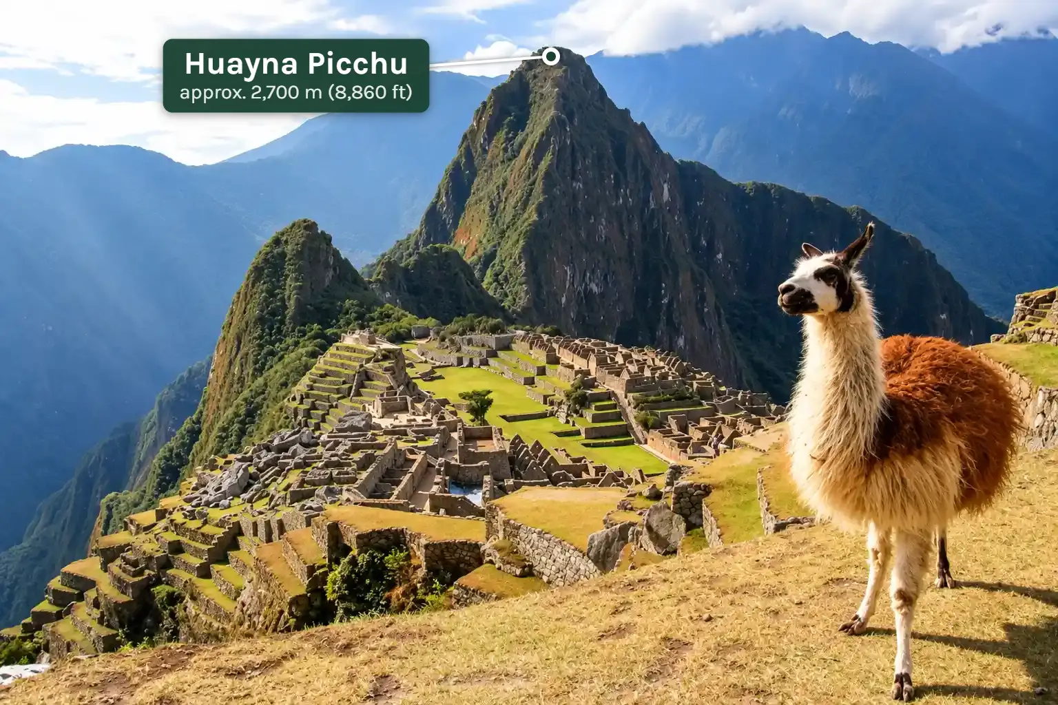
How high is Huayna Picchu?
The summit is at about 2,693 m (8,835 ft) by the most quoted measurement. Some local sources say 2,720 m, and no official survey figure is published.
What matters on the trail is the gain: roughly 270 m (890 ft) above the citadel, almost all of it on stone steps.
The Huayna Picchu hike, step by step
The trail starts in the lower part of the site. You walk Circuit 3 to the Sacred Rock, where a checkpoint stands. There you sign a logbook with your name, passport number and time, and you sign out again on the way back.
From the checkpoint the path first drops gently across the saddle between the two mountains. The turnoff to Huchuy Picchu is here.
Then the original Inca stairs begin and zigzag up through cloud forest. This is the longest part, steady and steep, with steel cables on the rock where the steps get high.
Near the top the steps become so narrow that you place your feet sideways and use your hands in places. A short rock tunnel forces most people to crouch.
The summit itself is a pile of bare boulders above a few Inca terraces and walls. Space is limited, so rangers keep people moving on busy days.
How long and how hard is the hike?
Plan on 45 to 60 minutes up and 30 to 45 minutes down. With time on the summit, the mountain takes two to three hours from the checkpoint and back.
The distance is short, roughly 2 km (1.2 miles) round trip. The difficulty comes from the gradient and the exposure, not the length. Most reasonably fit travelers make it. What stops people is fear of heights, not fitness.
The descent is the harder half for many. Steep steps feel steeper going down, so take it slowly and face the rock on the narrowest flights.
The “Stairs of Death”: what they really are
The name is an invention of the tourism industry, not an official one. It refers to the steepest flights in the upper part, where the drop to one side is long.
From June 1 to 30, 2026, the Ministry of Culture closed the mountain for conservation work. Crews reinforced stairs, retaining walls and drainage, and fitted new steel-cable railings on the steepest sections. The route reopened on July 1, 2026.
The deaths at the summit reported by Peruvian media were caused by heart failure, not by a fall from the stairs.
The bigger risk is the effort, not the trail. If you are sure-footed, take your time and stay on the path, you will get up and down safely.
What the Inca built on Huayna Picchu
The stairs you climb are Inca work, cut and laid in the 15th century along with the city below, which is generally attributed to the ruler Pachacútec.
Near the summit there are farming terraces on slopes that look impossible to build on, and a few small stone buildings. Their exact purpose is still debated. A lookout and a ceremonial site are the most common explanations.
Local guides tell a story that the high priest lived up here and walked down every morning to announce the new day in the city. Take it as tradition, not as documented history.
Temple of the Moon and the Great Cavern
The Temple of the Moon lies on the far side of Huayna Picchu and is not part of the summit ticket. It belongs to Route 3-C (Great Cavern), which opens only in high season and has 50 spots a day.
It works the other way around too: the Great Cavern ticket does not take you to the summit.
The view from the top
From the summit you look straight down on the Inca city, with Machu Picchu Mountain and the Sun Gate behind it. Far below, the Urubamba River wraps around the ridge, and the switchbacks of the bus road show on the slope.
There is only one thing you do not see: Huayna Picchu itself. The postcard view with the peak in the background is taken from the other side of the site.
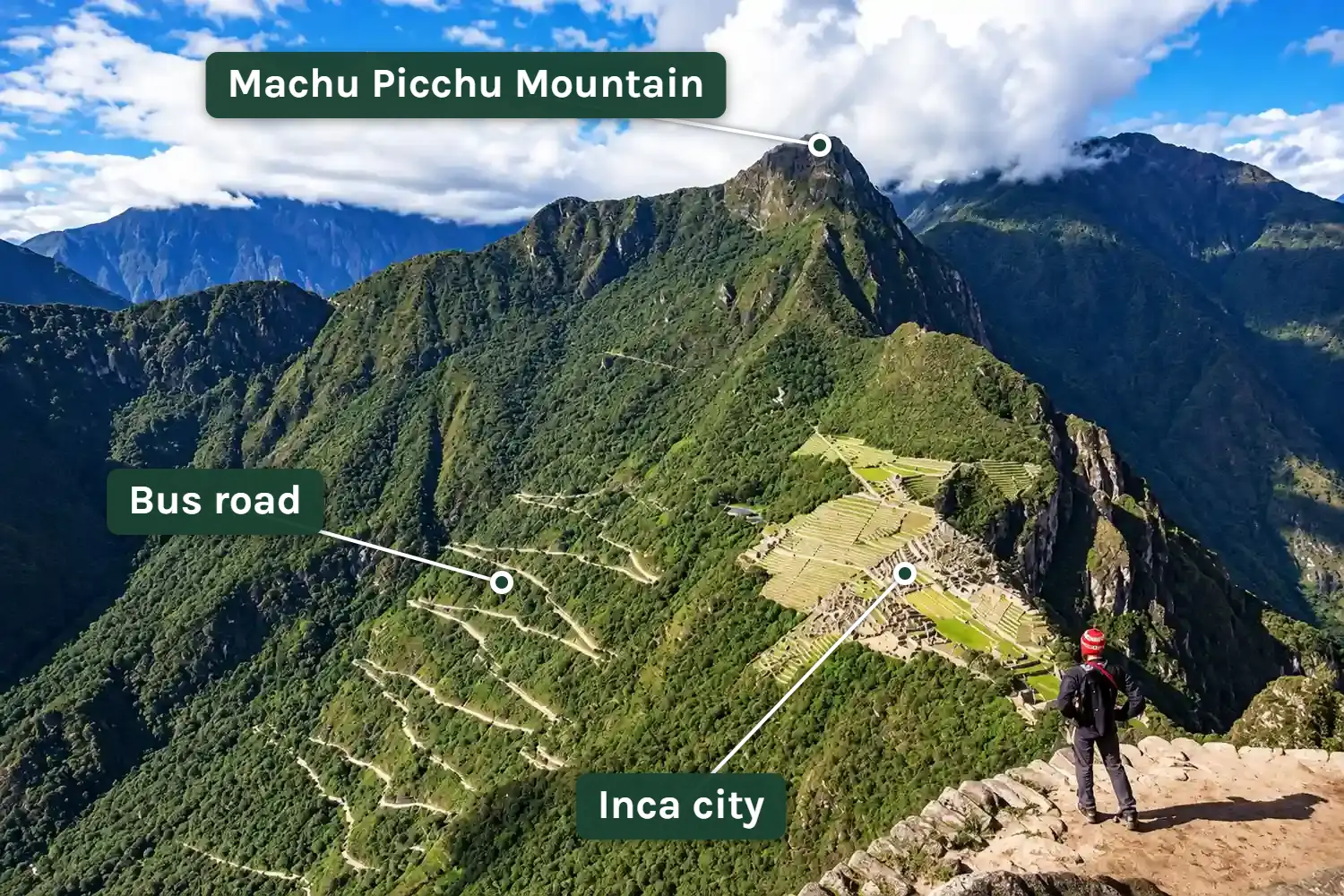
Entry times and daily spots in 2026
Huayna Picchu has 400 spots a day: 200 at 7 a.m. and 200 at 10 a.m. Of each group, 175 are sold online and 25 in person in Aguas Calientes.
Many websites still list a 9 a.m. second group, or 200 spots in total. Those figures are from earlier years. The numbers above are the ones in the official 2026 annex.
Machu Picchu Mountain: the highest viewpoint
Many travelers mix up the two names and call Huayna Picchu “Machu Picchu Mountain”. When you buy, check the route number: 3-A is Huayna Picchu, 1-A is Machu Picchu Mountain.
Machu Picchu Mountain, Montaña Machu Picchu in Spanish, stands directly opposite Huayna Picchu. Its name means “old peak”, and the Inca city on its slope is named after it.
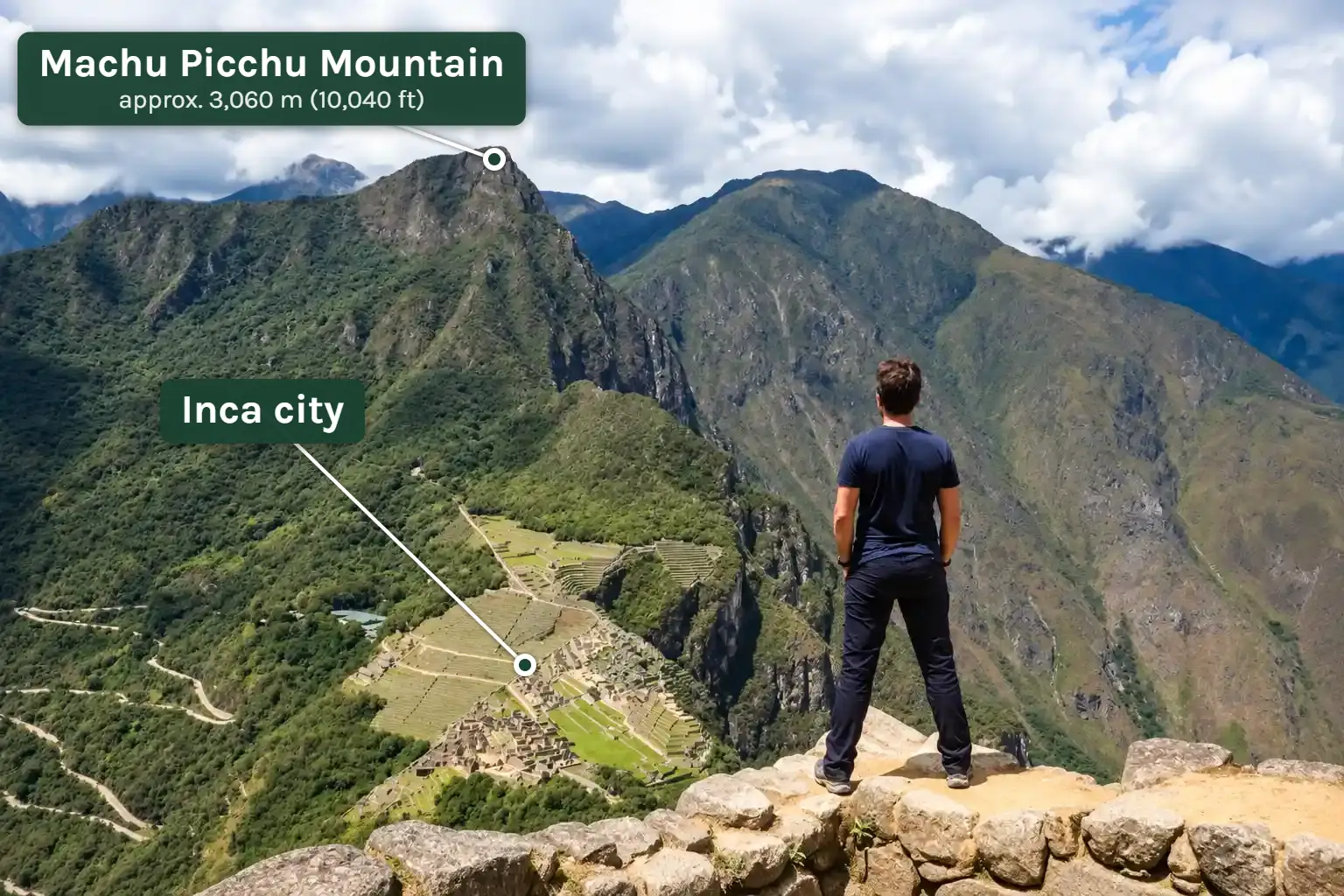
At just over 3,000 m (about 10,000 ft) it is the highest point you can reach with a regular entry ticket.
The trail branches off in the upper part of the site, near the terraces with the classic photo view. After the checkpoint comes one continuous climb on well over a thousand stone steps.
The path is wider than on Huayna Picchu and has fewer places with a drop right beside it. Only the last stretch before the summit gets steeper and narrower.
This mountain is tiring because of its length. About 630 m (2,070 ft) of gain in one go is noticeable at this altitude, even for experienced hikers. Allow three to four hours for the 3.8 km (2.4 miles) round trip.
At the top the whole sanctuary lies at your feet: the citadel with Huayna Picchu behind it, the Urubamba canyon, the last stretch of the Inca Trail to the Sun Gate and, on clear days, the glaciated Salkantay.
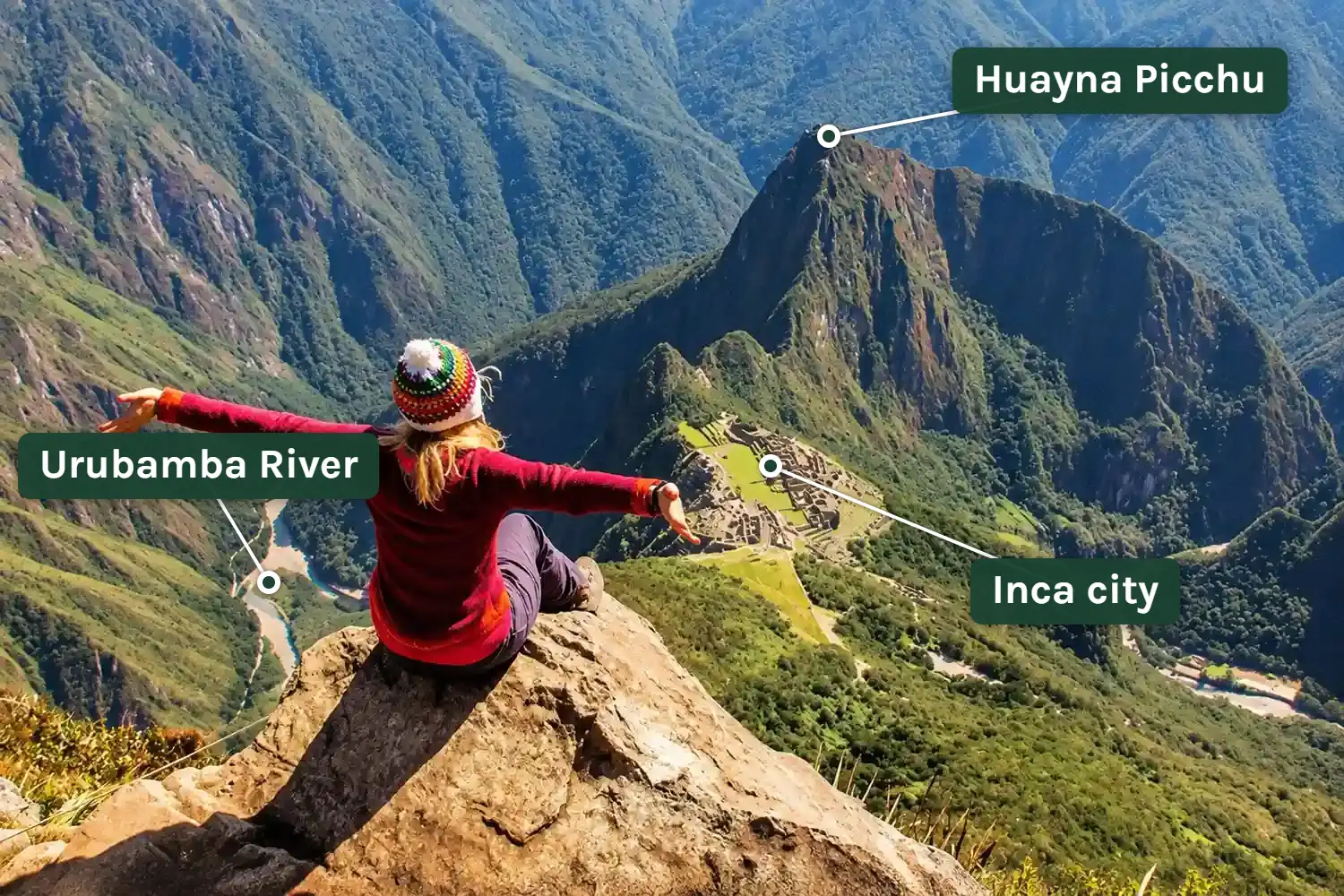
Less exposed does not mean risk free. In 2016 a visitor fell to his death here after stepping over the barrier for a photo.
And from March 8 to June 1, 2025 the route was closed after a landslide. In the rainy season that can happen again.
Huchuy Picchu: the short climb when time is tight
Huchuy Picchu means “small peak”, and that describes it exactly: a rocky hill right next to Huayna Picchu, barely 70 m (230 ft) higher than the city. Access is through the same checkpoint at the Sacred Rock, then the path turns left.
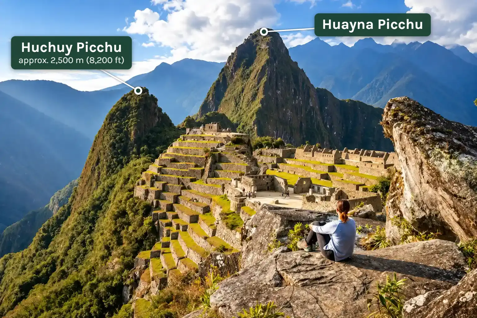
On stone steps you are at the top in about 20 minutes. The small viewpoint shows the main plaza and the lower sectors from an unusual angle, with the massive Huayna Picchu right beside you.
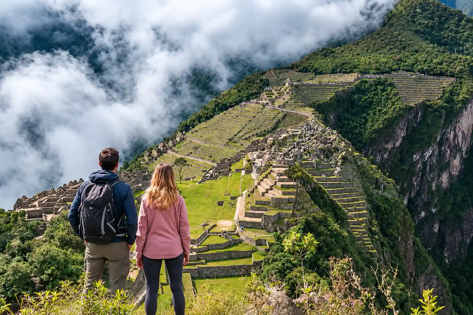
Two things to know. Route 3-D is open only in high season, and there are just 40 spots a day, 20 at 9 a.m. and 20 at 11 a.m.
That makes Huchuy Picchu the mountain route with the fewest tickets, although it is the easiest one, and in high season it often sells out before Huayna Picchu.
Which mountain has the better view?
It depends on the picture you want to take home. For the postcard shot with the city in front and Huayna Picchu behind, Machu Picchu Mountain is the right choice. Its circuit also crosses the upper terraces, where that photo is traditionally taken.
If you want the feeling of standing right above the ruins, you are better off on Huayna Picchu. The view is closer, steeper and more dramatic.
Circuit 3 does not go to the upper terraces, though, so you will miss the classic photo that day unless you buy a second ticket.
For the time of day there is a simple rule. In the dry season the early 7 a.m. entry pays off, because the view is usually clear in the morning.
In the rainy season fog often sits in the valley until 9 or 10 a.m. Then the second entry is the safer choice.
Difficulty, fear of heights and safety
Altitude is rarely the problem. Machu Picchu is about 1,000 m (3,300 ft) lower than Cusco, and anyone who has spent two or three days there is acclimatized. If you arrive straight from the coast, you will feel the thinner air mostly on Machu Picchu Mountain.
The real question is your head for heights and how steady you are on your feet:
- Huayna Picchu: you need both. With a strong fear of heights, we clearly advise against it.
- Machu Picchu Mountain: sure footing is usually enough. The summit area is airy, most of the trail is not.
- Huchuy Picchu: fine even with a mild fear of heights.
In rain the stone steps get slippery. Wear shoes with a grippy sole and allow more time for the descent than for the climb. Trekking poles are not allowed anywhere on the site under the official visitor rules.
If you have a heart or circulation condition, talk to your doctor before the trip. The climbs are short but intense, and there is no shade or quick help at the top.
Huayna Picchu is not meant for small children. Local operators agree that only visitors aged 12 and over are admitted, and minors must be with an adult.
You may read about an age limit of 18. That comes from a 2024 draft regulation. The 2026 official price list includes a rate for ages 3 to 17 on both mountain routes.
We know of no minimum age for Machu Picchu Mountain or Huchuy Picchu. Whether the long climb up Machu Picchu Mountain suits your child is a matter of stamina, not of rules.
Tickets, prices and entry times in 2026
A mountain is not an add-on to regular admission. It is a separate route with its own ticket.
For Huayna Picchu and Machu Picchu Mountain, foreign adults pay about $58 (200 soles) in 2026. Huchuy Picchu costs about $44 (152 soles), the same as a route without a mountain.
The trails are one way, and a mountain ticket shows you only the circuit it belongs to. Many of our travelers therefore buy two tickets: the classic Route 2-A for the walk through the city, plus Huayna Picchu.
The second popular combination is Circuit 1 for the photo from above, with Huayna Picchu. In our view, those are the two best combinations.
Two mountains in one day, on the other hand, hardly fit in the time available. If you want to climb both, plan two visiting days.
After you enter, go straight to your mountain’s checkpoint, because it admits hikers only within a limited window. Walk the rest of the circuit afterwards.
How far ahead should you book?
Tickets for a new year are released in the first or second week of January. For high season, these are the lead times we recommend from experience:
- Huayna Picchu: three to four months.
- Huchuy Picchu: also three to four months.
- Machu Picchu Mountain: one to two months is enough.
It surprises many people that the smallest mountain goes so early. The reason is the price.
Once the classic Route 2-A sells out, most people switch to Circuit 3, and Huchuy Picchu costs the same as the route without a mountain. So its 40 spots are often gone before Huayna Picchu.
Machu Picchu Mountain, by contrast, is almost always the mountain route that sells out last. If Huayna Picchu is gone for your date, look there.
In Aguas Calientes only 50 tickets a day are sold in person for Huayna Picchu and 50 for Machu Picchu Mountain. We explain the purchase step by step in our guide to Machu Picchu tickets.
When are the mountains open?
Huayna Picchu and Machu Picchu Mountain can be booked all year. Huchuy Picchu and the Great Cavern open only on the days the Ministry defines as high season. For 2026 those are:
- January 1
- April 2 to 5 (Easter week)
- June 19 to November 2
- December 30 and 31
On top of that come closures you cannot plan for: Huayna Picchu in June 2026 for maintenance, Machu Picchu Mountain in spring 2025 after a landslide. The Ministry has not said whether the June closure will repeat in 2027.
The driest months are May to September. From December to March it rains the most, and the chance of a clear view early in the morning drops sharply. More on that in our guide to the best time to visit Machu Picchu.
Does a mountain fit into your visit day?
For the 7 a.m. entry you have to sleep in Aguas Calientes. The bus to the citadel takes 25 to 30 minutes, and in high season the lines at the stop start forming around 5 a.m.
A day trip from Cusco does not work with that entry time.
With the mountain and the circuit you spend four to six hours on the site. After a 7 a.m. entry you are usually back in town between 1 and 2 p.m. So book your return train no earlier than mid-afternoon.
Huchuy Picchu is the exception. With entry at 9 or 11 a.m., it also works if you arrive that same morning from Ollantaytambo. We compare every way of getting there in our guide to the routes to Machu Picchu.
The most relaxed way to do a mountain is with a night in town. Our 2-day Machu Picchu tour by train is built exactly that way.
You can ask for a mountain on any of our tours. We check availability for your date and add it to your program if there are still spots.
What to pack for the climb
The site rules apply on the mountains too. Only a small daypack of up to 40 × 35 × 20 cm (about 16 × 14 × 8 in) is allowed.
- Passport: the original you booked the ticket with. It is checked at the entrance and at the mountain checkpoint.
- Water: one to two liters in a reusable bottle.
- Shoes: hiking or trekking shoes with tread.
- Rain jacket or poncho: umbrellas are not allowed.
- Sun protection: hat and sunscreen, there is no shade at the top.
- Insect repellent: as a cream or lotion, because aerosol cans are banned.
- Some cash in soles: for the restrooms at the entrance. There are none inside the site or on the mountains.
Which mountain is right for you?
After many conversations with travelers, the decision almost always comes down to these questions:
- You have a head for heights and want adventure: Huayna Picchu.
- You want the widest panorama and the classic photo on the same day: Machu Picchu Mountain.
- You are afraid of heights but walk well: Machu Picchu Mountain.
- You are short on time or want only a short climb: Huchuy Picchu, if your date falls in high season.
- It is your first time at Machu Picchu and you are unsure: start with the classic Route 2-A, because the city itself is the main goal. You can add a mountain with a second ticket.
If you want the mountain with train, hotel and guide in one booking, you will find all the options in our Machu Picchu tour packages.
Frequently asked questions about Huayna Picchu and the Machu Picchu mountains
How tall is Huayna Picchu?
About 2,693 m (8,835 ft) above sea level, which is roughly 270 m (890 ft) above the citadel of Machu Picchu.
Is Huayna Picchu dangerous?
The trail is steep and exposed, but it is secured with steel cables and, since July 2026, with new railings. If you have a head for heights, stay on the path and go slowly when it is wet, the risk is low.
Is Huayna Picchu worth it?
Yes, if you enjoy steep trails and are comfortable with heights. If your priority is the classic photo or an easier walk, Machu Picchu Mountain or the classic Route 2-A is the better use of your day.
Can I climb Huayna Picchu and Machu Picchu Mountain on the same day?
Only with two separate tickets, and the entry times leave almost no margin. We advise against it. It makes more sense to combine Huayna Picchu with the classic Route 2-A.
Do I get the classic postcard photo with a Huayna Picchu ticket?
No. Circuit 3 runs through the lower part of the site and does not reach the upper terraces. For the classic photo you need Route 1-A, 1-B, 2-A or 2-B, ideally as a second ticket for the same day.
How long does it take to climb Huayna Picchu?
About 45 to 60 minutes up and 30 to 45 minutes down. With a break at the summit, allow two to three hours.
What does Huayna Picchu look like?
Guides like to point out that the skyline behind the city, seen sideways, resembles a face looking up at the sky, with Huayna Picchu as the nose. Tilt your classic photo to the right and judge for yourself.
Is a mountain worth it in the rainy season?
Yes, with the second entry and good shoes. Expect fog in the morning, and be aware that a route can be closed at short notice after heavy rain.
Can I still get Huayna Picchu tickets on site?
The cultural center in Aguas Calientes sells 50 tickets a day for Huayna Picchu and 50 for Machu Picchu Mountain, normally for the following day. Do not count on it.